Le Massif
Overview
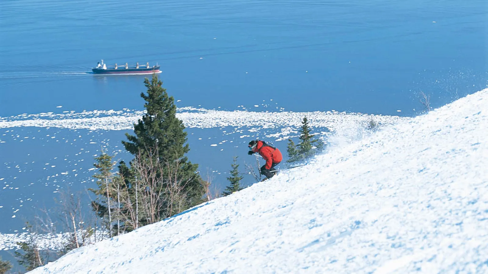
Le Massif’s most striking statistic is where its base sits: at 37.4 meters, barely above the level of the St. Lawrence River it overlooks, giving the mountain’s 791.5-meter summit a 754.1-meter vertical drop that starts almost at the water. The resort’s own French-language site rounds that figure to “770 m de dénivelé,” presenting it as the mountain’s defining number, and the difference from the independently tracked 754.1 meters reflects different measurement points rather than a discrepancy in the underlying terrain. That drop, combined with sweeping views out over the river valley, is central to how Le Massif markets itself, right down to a summit restaurant, Camp Boule, positioned to take in the scenery.
Nine lifts, a gondola, two platters, three chairlifts, and three magic carpets, serve 84 mapped runs and 50.91 kilometers of trail. The terrain mix skews toward the harder end: 13.34 kilometers advanced and 5.08 kilometers expert combine for 18.42 kilometers, more than a third of the mountain, while intermediate terrain is the largest single band at 18.09 kilometers and easy and novice terrain together add up to just under 10 kilometers.
Three passes reach Le Massif: the Ikon Pass for 7 no-blackout days, the Ikon Base Pass for 5 days with blackout dates, and Mountain Collective for 2 no-blackout days. The resort sits in Petite-Rivière-Saint-François, in Quebec’s Charlevoix region, about 90 minutes from Quebec City by road, and Quebec Jean Lesage International Airport, 81.5 kilometers away, doubles as both the nearest airport and the resort’s main gateway. Lévis, a city of roughly 143,400, is the closest population center at 69.2 kilometers, with Quebec City itself just slightly farther at 70.2 kilometers. Between the near-sea-level base, the river views, and a terrain profile weighted toward advanced and intermediate skiing, Le Massif stands apart from the flatter, more inland ski hills typical of eastern Canada.
The 84 mapped runs against 9 lifts work out to roughly 9.3 runs per lift, a moderate ratio for a resort of this vertical, and the mix of lift types, a summit gondola paired with platters, chairs, and magic carpets at different elevations, reflects a mountain built in stages to serve distinct zones rather than a single uniform lift network. Beyond winter, the resort keeps its Charlevoix base active with summer and fall programming through mid-October, including cable car rides and mountain biking that take advantage of the same near-continuous vertical drop used for skiing in winter. For visitors based in Quebec City, the roughly 90-minute drive northeast along the St. Lawrence makes Le Massif one of the more accessible major-vertical resorts in eastern Canada, a combination of scale and proximity that few other resorts profiled on this site can match.
All three of the resort’s nearest listed cities, Lévis, La Cité-Limoilou, and Québec, sit within a tight 70-kilometer band, effectively three neighborhoods of the same greater Quebec City area rather than distinct distant population centers, which reinforces just how tied Le Massif’s visitor base is to that single metro region. Three passes, Ikon, Ikon Base, and Mountain Collective, reach the resort, a broader multi-pass footprint than several other Quebec-area hills carry, giving both Canadian and visiting American or Japanese pass holders a direct route onto Le Massif’s terrain without a standalone lift ticket purchase.
Key stats
Official website — Last checked 2026-09-14
Lifts by type
| Type | Count |
|---|---|
| gondola | 1 |
| platter | 2 |
| chair lift | 3 |
| magic carpet | 3 |
Runs by difficulty
| Difficulty | Distance |
|---|---|
| easy | 8.98 km |
| other | 4.49 km |
| expert | 5.08 km |
| novice | 0.93 km |
| advanced | 13.34 km |
| intermediate | 18.09 km |
Maps
View official Le Massif trail map (image) →

Run & lift overview
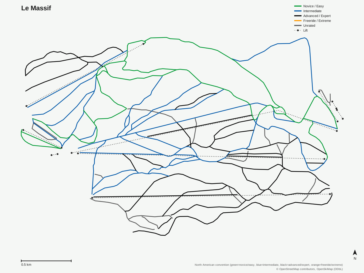
Le Massif: 84 runs, 9 lifts. A schematic built from OpenStreetMap/OpenSkiMap data — this is not Le Massif's official trail map. © OpenStreetMap contributors, OpenSkiMap (ODbL).
Typical conditions by month
Monthly conditions data for Le Massif is not yet available.
Lift tickets & passes
- Ikon Pass — 7 days, no blackout
- Ikon Base Pass — 5 days, blackout dates apply
- Mountain Collective — 2 days at this destination, no blackout dates
Getting there
Nearest airports
- Quebec Jean Lesage International Airport (YQB) — 81.5 km straight-line
- Saguenay-Bagotville Airport (YBG) — 120.5 km straight-line
- Roberval Airport (YRJ) — 185.9 km straight-line
Nearest cities
- Lévis, Quebec — 69.2 km straight-line
- La Cité-Limoilou, Quebec — 69.5 km straight-line
- Québec, Quebec — 70.2 km straight-line
Where to stay
A dedicated lodging guide for Le Massif is not yet available.
Nearby resorts
- Mont-Sainte-Anne — 33 km straight-line, 625.1 m vertical
- Centre de Ski Le Relais — 66 km straight-line, 221 m vertical
- Mont Grand-Fonds — 66 km straight-line, 330.7 m vertical
- Station touristique Stoneham — 66 km straight-line, 343.6 m vertical
- Mont Orignal — 97 km straight-line, 243.2 m vertical
FAQ
- Why is Le Massif's vertical drop notable?
- Le Massif's base sits at just 37.4 meters, close to the shoreline of the St. Lawrence River, so its 791.5-meter summit produces a 754.1-meter vertical, a rise the resort's own French-language marketing rounds to '770 m de dénivelé' as its defining statistic.
- How big is Le Massif?
- 9 lifts, a gondola, two platters, three chairlifts, and three magic carpets, serve 84 mapped runs across 50.91 kilometers of terrain.
- Is Le Massif good for advanced skiers?
- Combined advanced and expert terrain totals 18.42 of the resort's 50.91 mapped kilometers, over a third, with intermediate the largest single grade at 18.09 kilometers.
- Where is Le Massif located?
- In Petite-Rivière-Saint-François in Quebec's Charlevoix region, roughly 90 minutes from Quebec City, with views over the St. Lawrence River valley from the upper mountain.
- Which passes cover Le Massif?
- The Ikon Pass includes 7 days with no blackout dates, the Ikon Base Pass includes 5 days with blackout dates, and Mountain Collective includes 2 days with no blackout dates.
- What's the nearest airport to Le Massif?
- Quebec Jean Lesage International Airport is closest and also the resort's main gateway, 81.5 kilometers away.
- What's the nearest city to Le Massif?
- Lévis, Quebec, population around 143,400, is nearest at 69.2 kilometers, with Quebec City itself close behind at 70.2 kilometers.
- How many runs does Le Massif have relative to its lift count?
- 84 mapped runs across 9 lifts, a ratio of roughly 9.3 runs per lift, spread across a gondola, two platters, three chairlifts, and three magic carpets.
Data sources
Last verified: 2026-09-15
Base facts from OpenSkiMap (ODbL), OpenStreetMap contributors, Wikidata (CC0), OurAirports (public domain) and GeoNames (CC BY 4.0). See /data-sources/.