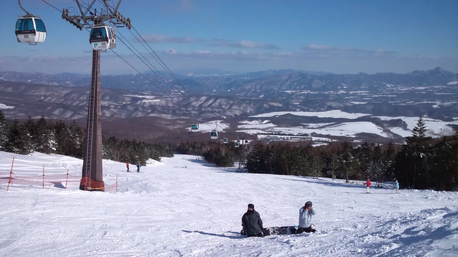
Palcall Tsumagoi Resort Ski & Hotel
Overview
Palcall Tsumagoi’s base sits at 1,386 m, the highest starting elevation of any resort in this group — high enough that the ski area is already well above most of the surrounding Gunma and Nagano countryside before a single lift is boarded. From there it climbs another 702.6 m to a 2,088.6 m summit, terrain served by six lifts: a single gondola and five chairs, moving skiers across 16 runs.
That 16-run count sounds modest, but at 15.45 km of combined length the resort isn’t tiny — it’s simply arranged around fewer, more substantial trails than some of its lower-elevation neighbors. The difficulty split favors accessible skiing: 6.74 km rated easy and 7.8 km intermediate account for the bulk of the terrain, with only 0.92 km of advanced-rated trail. That’s a gentler mix than several nearby Niigata- and Gunma-side resorts, which tend to carry a larger advanced share relative to their size.
The resort sits near the Gunma-Nagano border in the high plateau country around Tsumagoi, closer in practice to Nagano Prefecture’s cities than to anywhere in Gunma proper. Ueda, at about 23 km, and Nagano city itself, at roughly 26 km, are both closer than any city in Gunma, and Matsumoto is a further 56 km beyond that. Shinshu-Matsumoto Airport is the nearest airport at 64 km, but the resort’s recorded air gateway is Tokyo Haneda, some 164 km distant — reflecting that most international and long-haul visitors will still fly into Tokyo and drive or take a bus north rather than route through a smaller regional field.
Palcall Tsumagoi carries no listed pass affiliation, so tickets are bought directly rather than bundled into a multi-resort product, and the operator, reachable through tsumagoiskiresort.life, runs both the ski area and its adjoining hotel as a single package.
That 1,386 m base elevation is worth dwelling on, since it’s the highest starting point of any resort in this twenty-resort group — higher even than White World Oze Iwakura’s 1,042.8 m base, the next-highest on the list. Skiers accustomed to Japan’s many low-elevation coastal resorts, where base elevations under 300 m are common, will find the air here noticeably thinner and the snowpack typically more consistent through the season simply because there’s less margin-of-error elevation to lose to a warm spell.
The resort’s difficulty distribution is also worth spelling out in full: of the 15.45 km of trail, 6.74 km is rated easy, 7.8 km intermediate, and just 0.92 km advanced, meaning nearly all of the mountain sits comfortably within reach of a confident intermediate skier. That’s a gentler profile than several of the higher-elevation Japanese resorts covered in this group, including White World Oze Iwakura, whose terrain leans more heavily toward intermediate cruising with a smaller easy-terrain share — a useful distinction for visitors weighing the two high-plateau resorts against each other before booking either one. The Gunma-Nagano border region more broadly is dotted with smaller, hotel-anchored ski operations similar to Palcall Tsumagoi, many of which cater primarily to domestic weekend traffic from the greater Tokyo area rather than to international visitors, a pattern reflected in the resort’s own limited English-language web presence.
Key stats
Official website — Last checked 2026-09-13
Lifts by type
| Type | Count |
|---|---|
| gondola | 1 |
| chair lift | 5 |
Runs by difficulty
| Difficulty | Distance |
|---|---|
| easy | 6.74 km |
| advanced | 0.92 km |
| intermediate | 7.8 km |
Maps
View official Palcall Tsumagoi Resort Ski & Hotel trail map (image) →

Run & lift overview
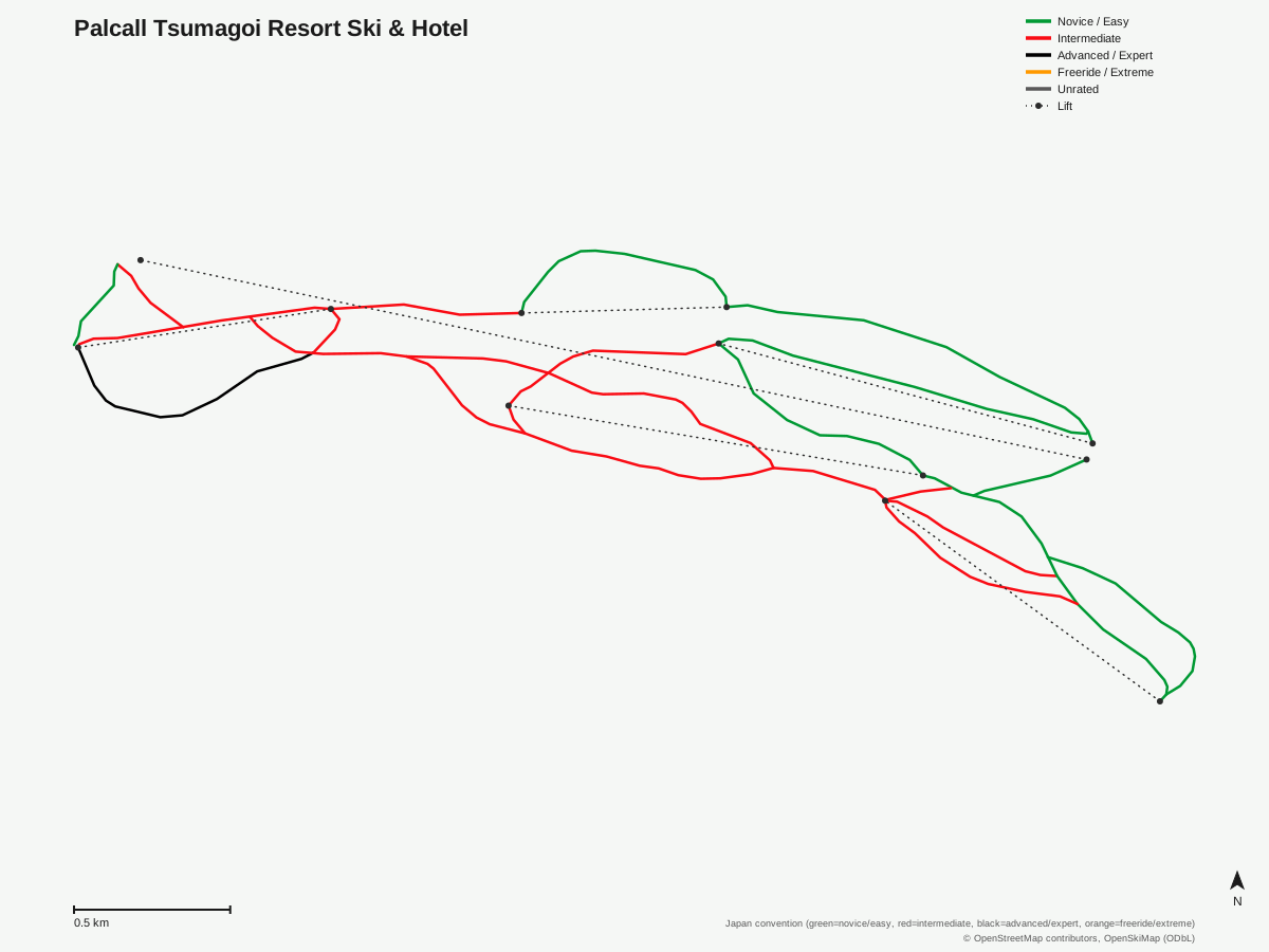
Palcall Tsumagoi Resort Ski & Hotel: 16 runs, 6 lifts. Drawn from OpenStreetMap run and lift data — not the official Palcall Tsumagoi Resort Ski & Hotel trail map. © OpenStreetMap contributors, OpenSkiMap (ODbL).
Typical conditions by month
Monthly conditions data for Palcall Tsumagoi Resort Ski & Hotel is not yet available.
Lift tickets & passes
Palcall Tsumagoi Resort Ski & Hotel has no multi-resort pass affiliations on record.
Getting there
Nearest airports
- Shinshu-Matsumoto Airport (MMJ) — 64.2 km straight-line
- Toyama Kitokito Airport (TOY) — 113.2 km straight-line
- Noto Satoyama Airport (NTQ) — 155.5 km straight-line
Nearest cities
- Ueda, Nagano — 22.9 km straight-line
- Nagano, Nagano — 25.9 km straight-line
- Matsumoto, Nagano — 56.3 km straight-line
Also covered by
Where to stay
A dedicated lodging guide for Palcall Tsumagoi Resort Ski & Hotel is not yet available.
Nearby resorts
- Sugadaira Kogen Davos Hill Ski Area — 9 km straight-line, 272.8 m vertical
- Kazawa Snow Area — 10 km straight-line, 316.4 m vertical
- Manza Onsen — 10 km straight-line, 298 m vertical
- Sugadairakogen Pine Beak Ski Area — 13 km straight-line, 381.5 m vertical
- Yamaboku Wild Snow Park — 13 km straight-line, 266.8 m vertical
FAQ
- How big is Palcall Tsumagoi Resort Ski & Hotel?
- Palcall Tsumagoi has a 702.6 m vertical drop from a 1,386 m base to a 2,088.6 m summit — the highest base elevation among the Japanese resorts covered here — across 16 runs totaling 15.45 km.
- Is Palcall Tsumagoi good for beginners?
- The resort leans easy-to-intermediate: 6.74 km of its 15.45 km of runs is rated easy and 7.8 km intermediate, with only 0.92 km classed advanced.
- Which pass covers Palcall Tsumagoi Resort Ski & Hotel?
- No multi-resort pass affiliation is on record; lift tickets are sold directly through the resort's own site.
- What's the nearest airport to Palcall Tsumagoi Resort Ski & Hotel?
- Shinshu-Matsumoto Airport (MMJ) is nearest at about 64 km, though the resort's recorded gateway airport is Tokyo Haneda (HND), roughly 164 km away.
- How many lifts does Palcall Tsumagoi Resort Ski & Hotel have?
- Six lifts serve the mountain, including one gondola and five chairlifts.
- Is Palcall Tsumagoi Resort Ski & Hotel close to Nagano?
- Nagano city is about 26 km away, and Ueda is closer still at roughly 23 km, making both practical bases for a visit.
- What is the highest-elevation resort in this group?
- Palcall Tsumagoi's 1,386 m base is the highest starting elevation among the twenty resorts covered here, ahead of White World Oze Iwakura's 1,042.8 m base as the second-highest.
- Is Palcall Tsumagoi Resort Ski & Hotel a ski-in ski-out property?
- The resort combines a ski area with an on-site hotel under one operator, based on its name and the tsumagoiskiresort.life site, though specific ski-in ski-out room details aren't independently confirmed here.
Data sources
Last verified: 2026-09-15
Base facts from OpenSkiMap (ODbL), OpenStreetMap contributors, Wikidata (CC0), OurAirports (public domain) and GeoNames (CC BY 4.0). See /data-sources/.