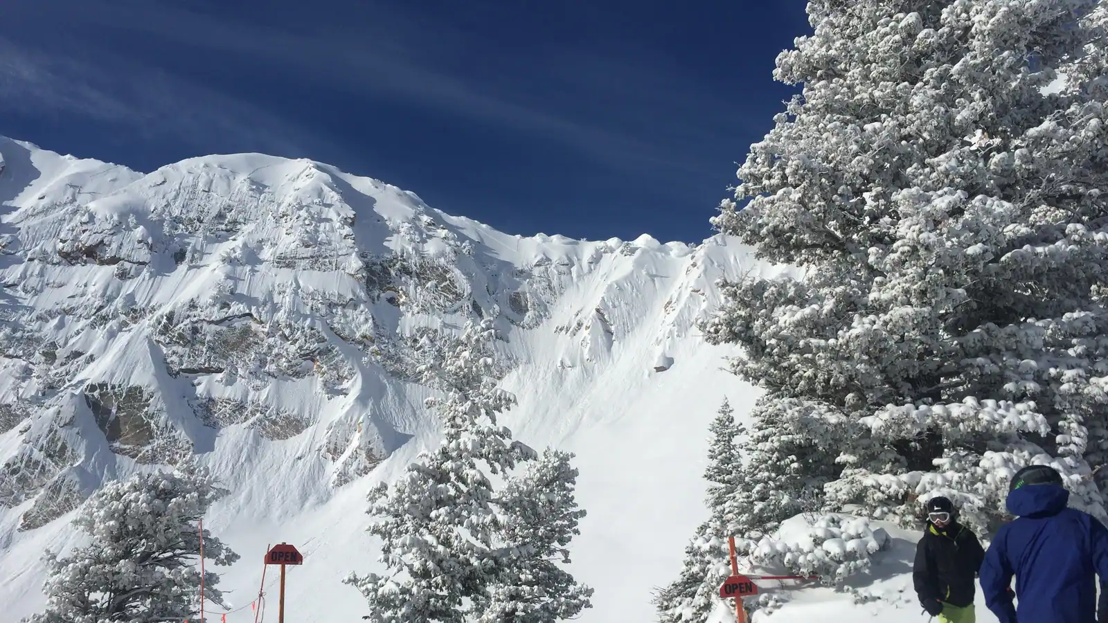
Snowbasin Resort
Overview
Snowbasin has been operating on Mount Ogden since 1939, developed originally by Weber County as part of an effort to restore the deteriorated Wheeler Creek watershed, which makes it one of the older continuously running ski areas in the country. Pete Seibert, who later founded Vail Ski Resort, ran Snowbasin from 1978 until financial trouble forced a sale in 1984, when Earl Holding, who also owns Sun Valley in Idaho, bought the resort; the Holding family still owns it today. That original watershed-restoration purpose is part of why the surrounding national forest land has stayed relatively undeveloped compared with resorts built primarily around base-area real estate.
On paper, Snowbasin is smaller than its Utah neighbors: 13 lifts, 153 runs, and 85.95 kilometers of trail across 896.6 meters of vertical. Two gondolas and a cable car move skiers up the mountain alongside seven chairlifts, a rope tow, and two magic carpets for the beginner-focused lower slopes, and the terrain leans toward intermediate (44.39 km) and advanced (33.68 km) skiing, with comparatively little marked beginner ground at just 7.81 km. This isn’t a resort built primarily for first-timers. The resort’s base sits at 1,938.6 meters, about 6,360 feet, and its summit at 2,835.2 meters, roughly 9,301 feet, a wide elevation band that reflects its position on Mount Ogden’s north-facing slopes. In imperial terms, the vertical drop works out to about 2,942 feet over roughly 53.4 miles of marked trail, and OpenStreetMap-based mapping finds the same 153 runs across the resort’s 13 lifts, matching Snowbasin’s own published trail count.
Snowbasin’s biggest calling card is its Olympic pedigree. It hosted the men’s and women’s downhill, combined, and super-G races at the 2002 Salt Lake City Games, drawing more than 124,000 spectators, and it’s expected to host alpine speed events again in 2034. It has also stood in as a filming location for Disney’s Frozen. Of the Ikon-affiliated northern Utah resorts, Snowbasin sits closest to a commercial airport: Ogden Hinckley is just 12.5 km from the base, versus roughly 47 km to Salt Lake City International, which makes it a practical option for anyone flying into the northern part of the state rather than routing through Salt Lake City. Salt Lake City itself, with about 215,548 residents, is the largest nearby population center at that same 47 km distance, while the Salt Lake Valley suburbs of West Valley City (population 136,208, about 57.8 km) and West Jordan (population 111,946, about 66.1 km) sit a little farther south.
Ikon Pass holders get seven blackout-free days at Snowbasin, and Mountain Collective adds two more days with no blackout dates; the Ikon Base Pass, as at Deer Valley, doesn’t include it. Snowbasin’s own marketing calls it one of Utah’s more accessible resorts, pointing to free parking and a compact lift system that moves people up the mountain quickly rather than a sprawling multi-village layout.
Key stats
Official website — Last checked 2026-09-13
Lifts by type
| Type | Count |
|---|---|
| gondola | 2 |
| rope tow | 1 |
| cable car | 1 |
| chair lift | 7 |
| magic carpet | 2 |
Runs by difficulty
| Difficulty | Distance |
|---|---|
| easy | 7.81 km |
| other | 0.08 km |
| advanced | 33.68 km |
| intermediate | 44.39 km |
Maps
View official Snowbasin Resort trail map (PDF) →
Run & lift overview
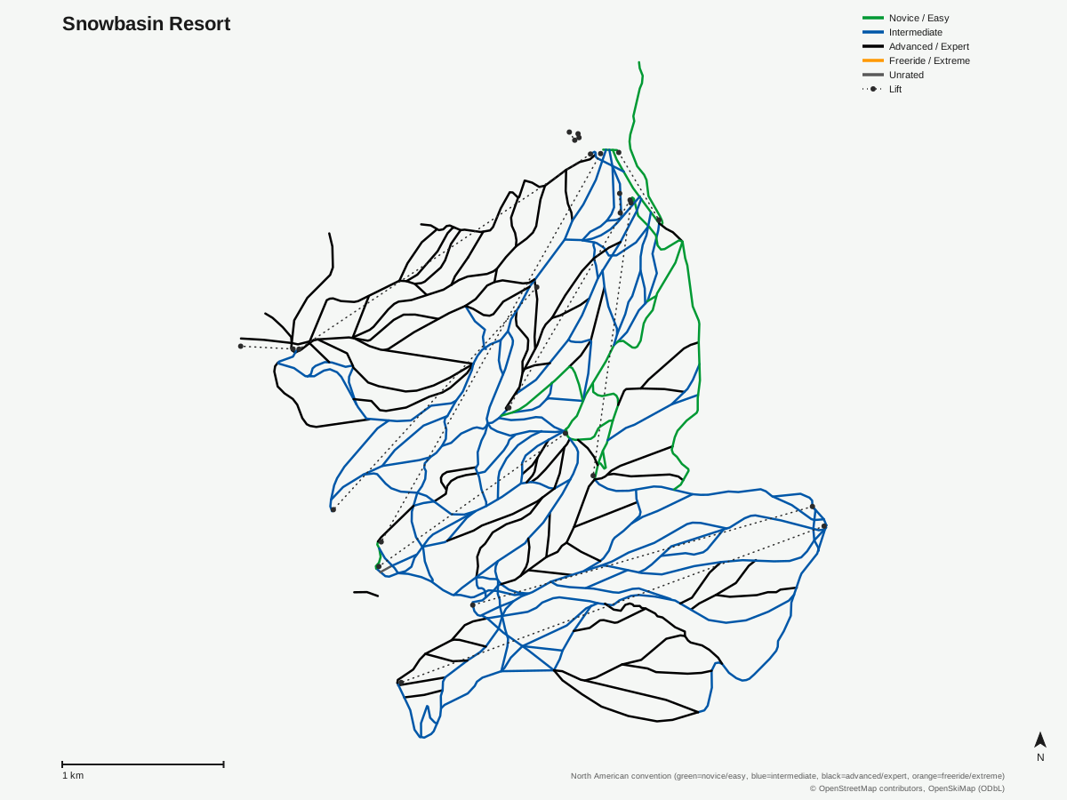
Snowbasin Resort: 153 runs, 13 lifts. Drawn from OpenStreetMap run and lift data — not the official Snowbasin Resort trail map. © OpenStreetMap contributors, OpenSkiMap (ODbL).
Typical conditions by month
Monthly conditions data for Snowbasin Resort is not yet available.
Lift tickets & passes
- Ikon Pass — 7 days, no blackout
- Ikon Base Pass — No access
- Mountain Collective — 2 days at this destination, no blackout dates
Getting there
Nearest airports
- Ogden Hinckley Airport (OGD) — 12.5 km straight-line
- Salt Lake City International Airport (SLC) — 46.9 km straight-line
- Provo Municipal Airport (PVU) — 109.8 km straight-line
Nearest cities
- Salt Lake City, Utah — 49 km straight-line
- West Valley City, Utah — 57.8 km straight-line
- West Jordan, Utah — 66.1 km straight-line
Also covered by
Where to stay
A dedicated lodging guide for Snowbasin Resort is not yet available.
Nearby resorts
- Nordic Valley Resort — 12 km straight-line, 518.2 m vertical
- Powder Mountain Ski Resort — 21 km straight-line, 722 m vertical
- Park City Mountain Resort — 66 km straight-line, 990.1 m vertical
- Solitude Mountain Resort — 69 km straight-line, 612.3 m vertical
- Brighton Resort — 71 km straight-line, 518.7 m vertical
FAQ
- How big is Snowbasin Resort?
- Snowbasin has 13 lifts, 153 runs, and 85.95 kilometers of trail across 896.6 meters of vertical. It's smaller than nearby Park City or Deer Valley by lift count and trail mileage, but its vertical drop is substantial for a resort of its size.
- Which pass covers Snowbasin?
- Snowbasin is on the Ikon Pass, which includes seven blackout-free days, and Mountain Collective, which adds two more days here with no blackout dates. The Ikon Base Pass does not include Snowbasin.
- Is Snowbasin good for beginners or experts?
- The terrain data shows a base weighted toward intermediate (44.39 km) and advanced (33.68 km) skiing, with comparatively little marked beginner ground at 7.81 km. It's not a resort built primarily around first-timer terrain.
- What's the nearest airport to Snowbasin?
- Ogden Hinckley Airport is just 12.5 km from the base, making Snowbasin the most airport-accessible of the northern Utah resorts in this area. Salt Lake City International, the larger commercial gateway, is about 47 km away.
- Did Snowbasin host the Winter Olympics?
- Yes. It hosted the men's and women's downhill, combined, and super-G alpine skiing events at the 2002 Salt Lake City Games, drawing more than 124,000 spectators across the three events. It's expected to host alpine speed events again in 2034.
- How old is Snowbasin?
- Snowbasin has operated on Mount Ogden since 1939, making it one of the older continuously running ski areas in the country. Pete Seibert, who later founded Vail Ski Resort, ran the property from 1978 until 1984, when Earl Holding, who also owns Sun Valley in Idaho, purchased it.
- Is Snowbasin good for a day trip from Salt Lake City?
- It works well for one: the drive from Salt Lake City International Airport is roughly 47 km, and the resort has historically emphasized free parking as part of its accessibility pitch. Two gondolas and a cable car move skiers up the mountain quickly once you arrive.
Data sources
Last verified: 2026-09-15
Base facts from OpenSkiMap (ODbL), OpenStreetMap contributors, Wikidata (CC0), OurAirports (public domain) and GeoNames (CC BY 4.0). See /data-sources/.