Tazawako Ski Resort
Overview
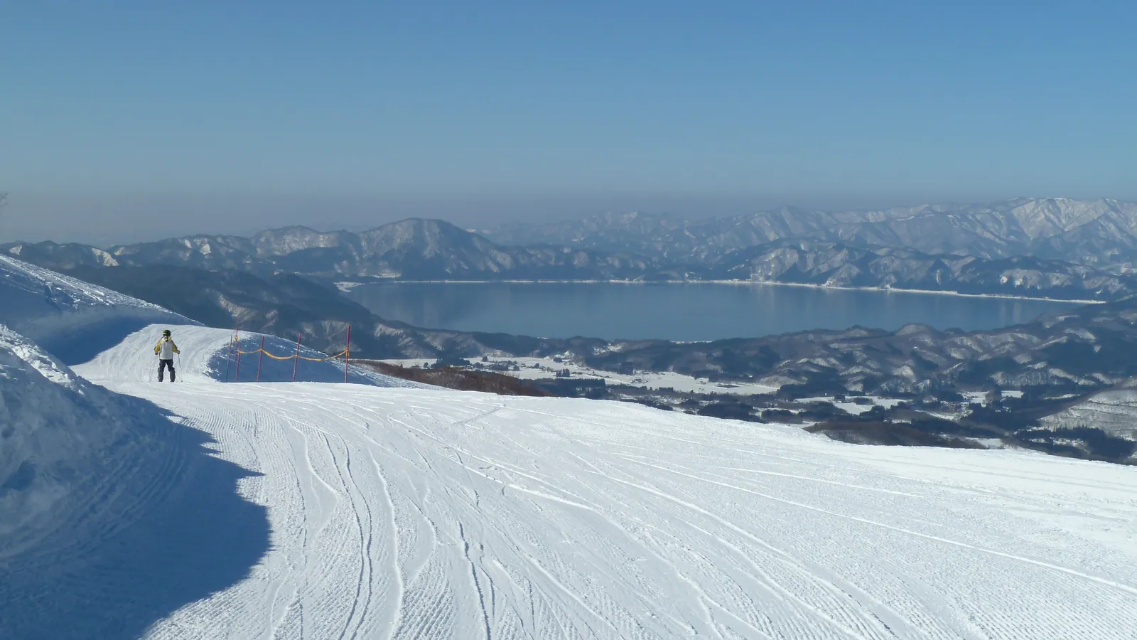
Tazawako Ski Resort looks out over Lake Tazawa, Japan’s deepest lake, from slopes in Semboku City, Akita Prefecture — a vantage point central to how the resort presents itself, since open lake scenery is uncommon among Japanese ski areas cut into steeper terrain. The ski area itself is mid-sized by the numbers: a base elevation of 576.7 meters, a top station at 1,173.1 meters, and a vertical drop of 596.4 meters, served by six chairlifts across 16 runs totaling 11.44 km. Terrain runs slightly toward the advanced side compared with some neighboring Akita resorts: 5.29 km (46%) is easy, 3.99 km (35%) intermediate, and 2.17 km (19%) advanced, a larger advanced share than the lakeside setting might suggest.
Getting there doesn’t require flying into a major hub. The resort’s own site describes it as roughly 30 minutes by bus from Tazawako Station, with an Airport Liner service connecting from Akita Airport, which sits 50.1 km away. Iwate Hanamaki Airport (48.5 km) is marginally closer, and Odate Noshiro Airport (58.7 km) is a third regional option, though Aomori Airport (108.2 km) is the resort’s listed formal gateway. Morioka (33.1 km, population 290,700) is the nearest sizeable city, ahead of Akita city itself (56.3 km, population 307,672) and Ōshū (77.2 km, population 112,937).
On the mountain, Tazawako is known locally for slope-side dining that changes seasonally, plus newer lounge facilities and a snow park with tree-run options alongside its groomed pistes. No major multi-resort pass — Ikon, Epic, or Indy — currently lists Tazawako among its partners, so tickets here are resort-specific.
By the numbers, Tazawako is a compact mountain: 16 runs across 11.44 km works out to an average of roughly 715 meters per run, and the six chairlifts translate to about 1.9 km of piste per lift, on the higher end of lift-to-terrain ratios among the smaller Tohoku resorts. That compactness, combined with a 596.4-meter vertical squeezed into a relatively short base-to-summit run, gives Tazawako steeper average pitch per run than some larger, more sprawling Akita-area mountains, even without any terrain graded expert or double-black in the current run data. Skiers looking for volume rather than a quick, scenic session are better served by one of the larger resorts elsewhere in this region; Tazawako’s appeal leans on the lake views and the compact, easy-to-lap layout rather than acreage.
Set against Amihari Onsen and Iwate Kogen Snow Park, two other Tohoku-region resorts in this comparison set, Tazawako’s vertical drop of 596.4 meters is the largest of the three despite having the smallest lift count at six, meaning each lift here covers more ground on average than at those two neighbors. Of the three, Tazawako’s terrain also carries the largest advanced-graded share by percentage: 19% of its total against roughly 13% at Amihari and under 8% at Iwate Kogen, whose run data leans much more heavily toward easy terrain at 68% of the mountain. That combination of a large vertical on a small lift count and a comparatively technical run mix distinguishes Tazawako from the area’s more beginner-oriented mountains, even at its modest overall scale, and its lake-view setting has no real equivalent among the other Tohoku resorts in this comparison.
Key stats
Official website — Last checked 2026-09-13
Lifts by type
| Type | Count |
|---|---|
| chair lift | 6 |
Runs by difficulty
| Difficulty | Distance |
|---|---|
| easy | 5.29 km |
| advanced | 2.17 km |
| intermediate | 3.99 km |
Maps
View official Tazawako Ski Resort trail map (PDF) →
Run & lift overview
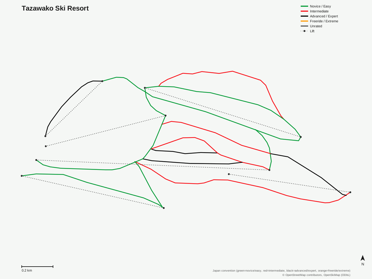
Tazawako Ski Resort: 16 runs, 6 lifts. Generated from community-mapped OpenStreetMap data, not Tazawako Ski Resort's official map artwork. © OpenStreetMap contributors, OpenSkiMap (ODbL).
Typical conditions by month
Monthly conditions data for Tazawako Ski Resort is not yet available.
Lift tickets & passes
Tazawako Ski Resort has no multi-resort pass affiliations on record.
Getting there
Nearest airports
- Iwate Hanamaki Airport (HNA) — 48.5 km straight-line
- Akita Airport (AXT) — 50.1 km straight-line
- Odate Noshiro Airport (ONJ) — 58.7 km straight-line
Nearest cities
- Morioka, Iwate — 33.1 km straight-line
- Akita, Akita — 56.3 km straight-line
- Ōshū, Iwate — 77.2 km straight-line
Also covered by
Where to stay
A dedicated lodging guide for Tazawako Ski Resort is not yet available.
Nearby resorts
- Shizukuishi Ski Resort — 13 km straight-line, 710.6 m vertical
- Amihari Onsen Ski Resort — 16 km straight-line, 560.8 m vertical
- Iwate Kogen Snow Park — 18 km straight-line, 561.6 m vertical
- Hachimantai Resort Shimokura Ski Area — 21 km straight-line, 518.8 m vertical
- Hachimantai Resort Panorama Ski Area — 22 km straight-line, 417.7 m vertical
FAQ
- What makes Tazawako Ski Resort's location distinctive?
- Its slopes overlook Lake Tazawa, Japan's deepest lake, from a base in Semboku City, Akita Prefecture.
- What's the vertical drop and lift count at Tazawako?
- A 596.4-meter vertical drop from a 1,173.1-meter summit down to a 576.7-meter base, served by six chairlifts across 16 runs.
- How much of Tazawako's terrain is advanced?
- 2.17 km, about 19% of the resort's 11.44 km total, is rated advanced, a notably higher share than the roughly 46% easy and 35% intermediate split.
- How do you get to Tazawako Ski Resort without a car?
- It's about 30 minutes by bus from Tazawako Station, and an Airport Liner service runs from Akita Airport, 50.1 km from the resort.
- What's the nearest city to Tazawako Ski Resort?
- Morioka, 33.1 km away with a population of about 290,700, is closer than Akita city (56.3 km) or Ōshū (77.2 km).
- Does Tazawako Ski Resort accept the Ikon or Indy Pass?
- Tazawako doesn't appear among Ikon, Epic, or Indy partner resorts in the available data, so skiers purchase tickets directly at the mountain.
- How long is the average run at Tazawako?
- With 16 runs across 11.44 km, the average comes out to roughly 715 meters per run, and the resort's six chairlifts work out to about 1.9 km of piste per lift, a fairly generous ratio for a small Akita ski area.
- Is Tazawako Ski Resort a big mountain?
- No, it's on the smaller side even among Akita and Iwate resorts, with just 16 runs and 11.44 km of trail. What it lacks in scale it makes up for with the lake view and the relatively steep, 596.4-meter vertical packed into that footprint.
Data sources
Last verified: 2026-09-15
Base facts from OpenSkiMap (ODbL), OpenStreetMap contributors, Wikidata (CC0), OurAirports (public domain) and GeoNames (CC BY 4.0). See /data-sources/.