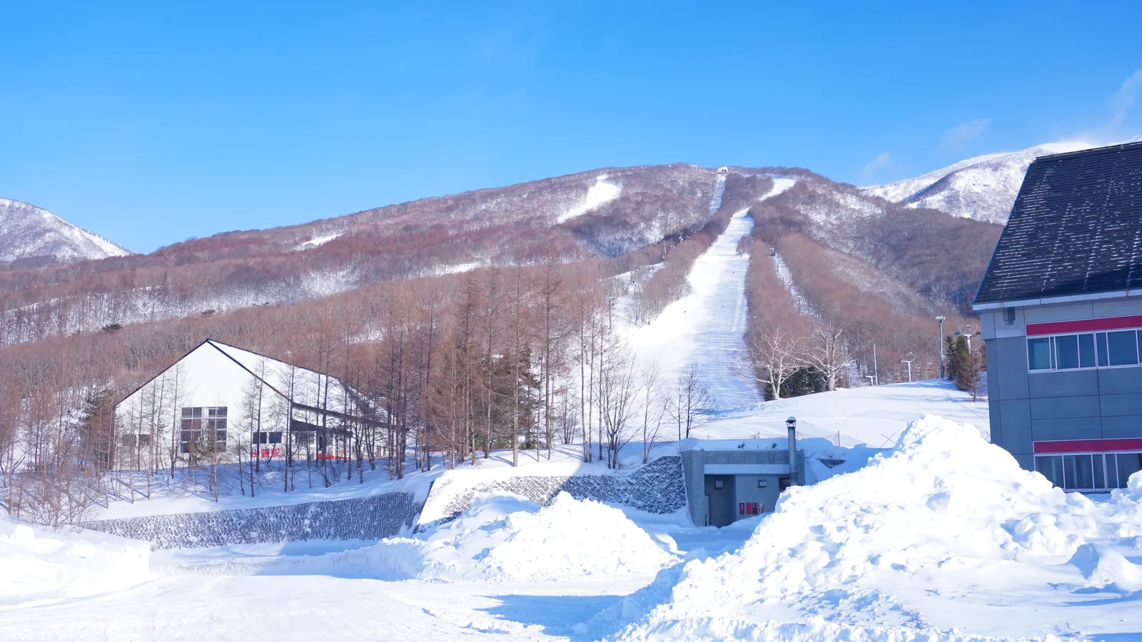
Iwate Kogen Snow Park
Overview
Iwate Kogen Snow Park delivers 561.6 meters of vertical, climbing from a 645.8-meter base to a 1,207.4-meter summit. That drop is served by six lifts, a gondola plus five chairlifts, a setup with more lift variety than most resorts of this size in the prefecture. Twelve runs are mapped for 9.31 kilometers total, and the terrain leans heavily easy: 6.33 kilometers carry that grading, well over two-thirds of the mountain, with 2.02 kilometers intermediate, 0.73 kilometers advanced, and a small 0.23-kilometer novice run rounding out the count.
According to Wikidata’s entry for the resort, Iwate Kogen Snow Park sits within Shizukuishi, a town in Iwate Prefecture near coordinates 39°49′N, 140°58′E, consistent with the resort’s listed position north of Morioka. Morioka itself, the prefectural capital with a population near 291,000, sits about 21 kilometers off, the nearest population center of any real size, well ahead of Akita city and Ōshū, both further out at 74 and 78 kilometers.
By air, Iwate Hanamaki Airport is the nearest option at under 46 kilometers, with Odate Noshiro and Akita airports both around 65 to 68 kilometers as alternatives; Aomori Airport, almost 104 kilometers away, is listed as the wider region’s gateway. Iwate Kogen doesn’t appear on any multi-resort lift pass in current listings, unlike neighboring Amihari’s coverage under the Indy Pass network, so tickets here look to be sold directly by the resort.
By the numbers, Iwate Kogen’s 12 runs and 9.31 kilometers of piste average out to roughly 775 meters per run, among the longer average run lengths of the smaller Tohoku resorts, helped by a single gondola that reaches well up the 561.6-meter vertical rather than relying on chairlifts alone for the upper mountain. The six-lift network works out to about 1.55 kilometers of trail per lift, a middling ratio that points to a resort sized for steady local and regional skier traffic rather than large weekend crowds. Despite its modest run count, the mountain’s vertical drop holds up well against several larger-looking neighbors in the prefecture, a reminder that total trail mileage and vertical don’t always scale together at these smaller Japanese ski areas.
Of the five small Japanese resorts covered in this comparison set, Iwate Kogen has both the smallest total run count, 12 runs, and the smallest total trail distance at 9.31 km, yet its 561.6-meter vertical sits within about a meter or two of Amihari Onsen’s and Oguna Hotaka’s, both of which post nearly identical figures despite mapping more runs. That gap between a compact run count and a competitive vertical suggests a mountain built around a small number of longer descents rather than a dense web of shorter connector trails, an impression reinforced by the resort’s above-average 775-meter run length within this group, the longest average of the five resorts by a clear margin. For skiers who value fewer, longer runs over a dense web of short connector trails, that run-length profile is arguably a better indicator of on-mountain experience than the total run count alone, especially on a mountain where the gondola alone accounts for a meaningful share of the vertical covered.
Key stats
Official website — Last checked 2026-09-13
Lifts by type
| Type | Count |
|---|---|
| gondola | 1 |
| chair lift | 5 |
Runs by difficulty
| Difficulty | Distance |
|---|---|
| easy | 6.33 km |
| novice | 0.23 km |
| advanced | 0.73 km |
| intermediate | 2.02 km |
Maps
Official trail map: see iwatekogen.jp
Run & lift overview
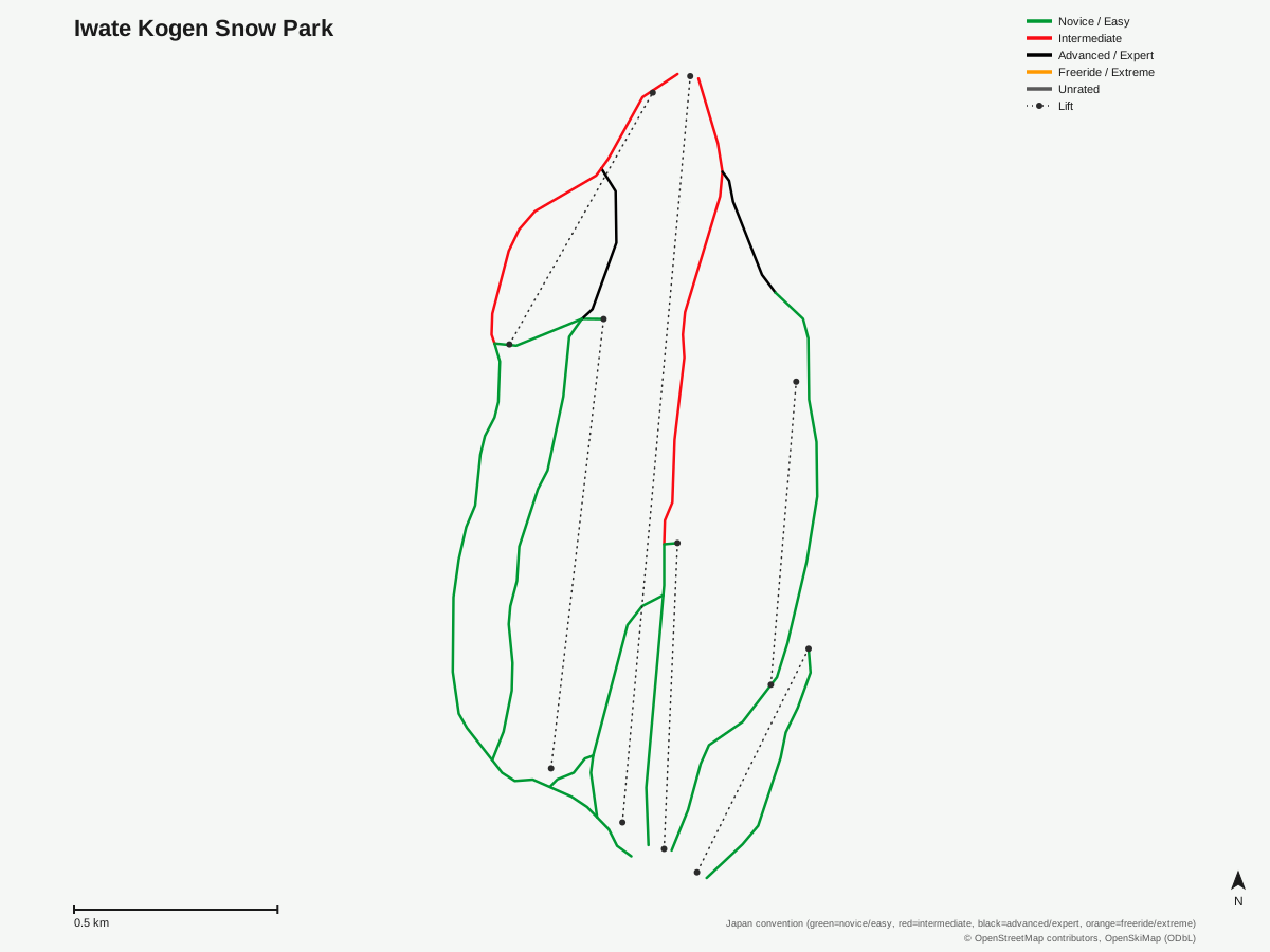
Iwate Kogen Snow Park: 12 runs, 6 lifts. Generated from community-mapped OpenStreetMap data, not Iwate Kogen Snow Park's official map artwork. © OpenStreetMap contributors, OpenSkiMap (ODbL).
Typical conditions by month
Monthly conditions data for Iwate Kogen Snow Park is not yet available.
Lift tickets & passes
Iwate Kogen Snow Park has no multi-resort pass affiliations on record.
Getting there
Nearest airports
- Iwate Hanamaki Airport (HNA) — 45.9 km straight-line
- Odate Noshiro Airport (ONJ) — 65.4 km straight-line
- Akita Airport (AXT) — 67.8 km straight-line
Nearest cities
- Morioka, Iwate — 20.6 km straight-line
- Akita, Akita — 73.5 km straight-line
- Ōshū, Iwate — 77.7 km straight-line
Also covered by
Where to stay
A dedicated lodging guide for Iwate Kogen Snow Park is not yet available.
Nearby resorts
- Amihari Onsen Ski Resort — 3 km straight-line, 560.8 m vertical
- Shizukuishi Ski Resort — 6 km straight-line, 710.6 m vertical
- Hachimantai Resort Panorama Ski Area — 7 km straight-line, 417.7 m vertical
- Hachimantai Resort Shimokura Ski Area — 9 km straight-line, 518.8 m vertical
- Tazawako Ski Resort — 18 km straight-line, 596.4 m vertical
FAQ
- What's the vertical drop at Iwate Kogen Snow Park?
- 561.6 meters, from a base of 645.8 meters to a top elevation of 1,207.4 meters.
- Does Iwate Kogen Snow Park have a gondola?
- Yes, one gondola supplements five chairlifts for six lifts in total.
- Where exactly is Iwate Kogen Snow Park located?
- It sits in the town of Shizukuishi in Iwate Prefecture, according to Wikidata's entry for the resort, roughly 21 kilometers from the prefectural capital Morioka.
- How much of Iwate Kogen Snow Park is beginner terrain?
- 6.33 kilometers are graded easy out of 9.31 total kilometers across 12 runs, so easy terrain covers roughly two-thirds of the mapped piste.
- What's the nearest airport to Iwate Kogen Snow Park?
- Iwate Hanamaki Airport, under 46 kilometers away, is the closest option, with Odate Noshiro and Akita airports both in the 65-68 kilometer range as alternatives.
- Are there advanced runs at Iwate Kogen Snow Park?
- A modest 0.73 kilometers are graded advanced, a small share next to the 6.33 kilometers of easy terrain and 2.02 kilometers of intermediate runs.
- How long is the average run at Iwate Kogen Snow Park?
- With 12 runs across 9.31 km, the average works out to about 775 meters, and the six lifts translate to roughly 1.55 km of piste per lift, aided by the single gondola that reaches well up the mountain.
- Is Iwate Kogen Snow Park a big resort?
- No, it's a smaller operation even by the standards of nearby Iwate and Akita ski areas, with just 12 mapped runs and 9.31 km of total piste, though its 561.6-meter vertical is comparable to several larger-looking neighbors.
Data sources
Last verified: 2026-09-15
Base facts from OpenSkiMap (ODbL), OpenStreetMap contributors, Wikidata (CC0), OurAirports (public domain) and GeoNames (CC BY 4.0). See /data-sources/.