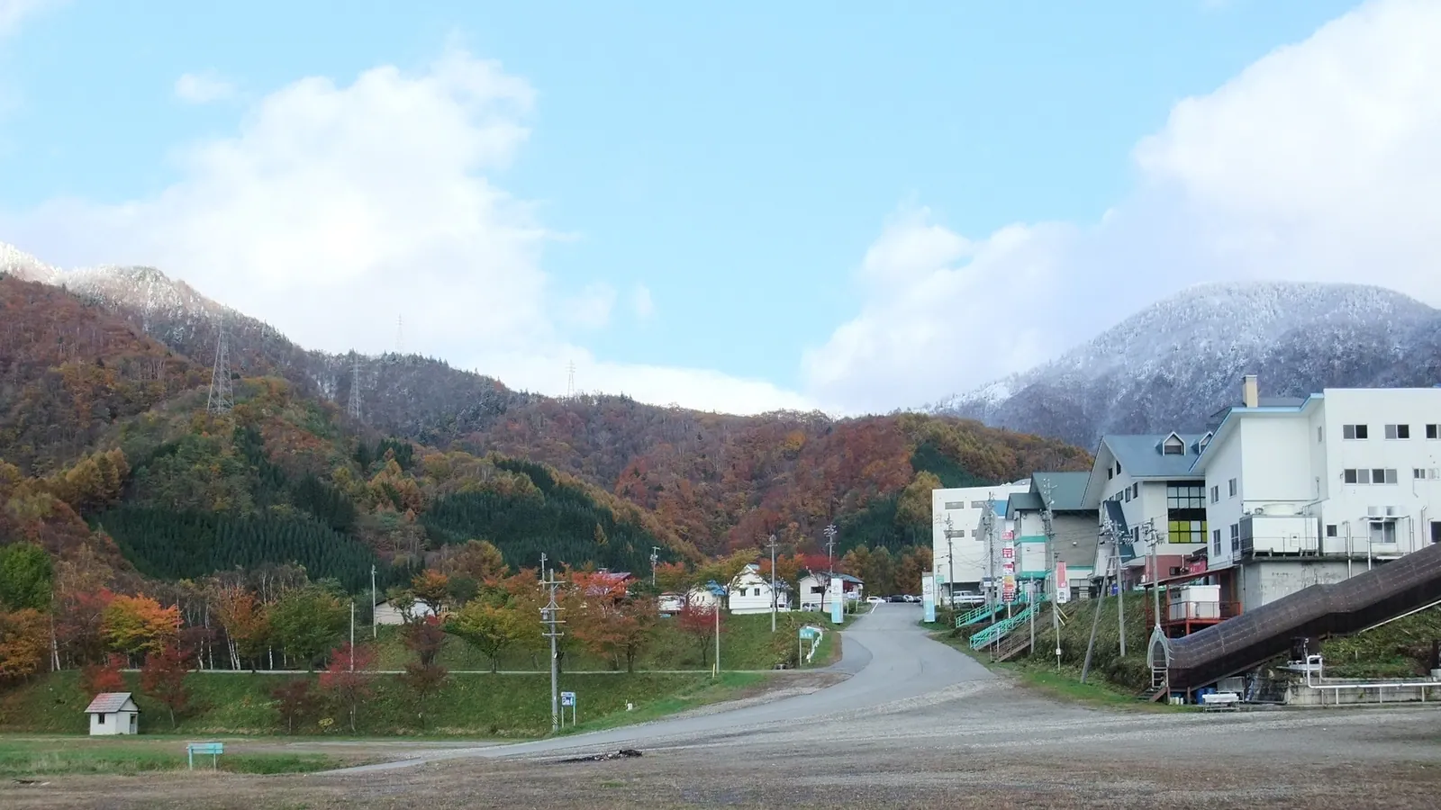
Honokidaira Ski Area
Overview
Honokidaira Ski Area sits in the mountains above Takayama, in Gifu Prefecture, a part of the Japanese Alps better known for dry, high-altitude powder than the heavier coastal snow that piles up on resorts closer to the Sea of Japan. The ski area occupies a genuinely elevated site, with terrain running from roughly 1,230.4m up to 1,537.3m — a base elevation high enough that Honokidaira sits above many of the region’s lower valley resorts, generally a point in favor of natural snow quality through the season.
Five chairlifts serve the mountain’s 16 runs, which together cover 8.78km and add up to a 306.9m vertical drop. The terrain leans toward skiers who already have some mileage: 2.84km is rated intermediate and 2.3km advanced, against 3.44km easy and a small 0.2km novice strip for newer skiers finding their footing. It’s a small operation by design, receiving supplementary funding from Gifu Prefecture as part of the region’s public winter-recreation infrastructure rather than running as a purely commercial resort, and it maintains a live camera feed so locals and visitors can check conditions before making the drive up.
Once the season ends, Honokidaira doesn’t sit idle — the same slopes are replanted as a sunflower garden, a green-season use of the site that mirrors how several of the smaller ski areas scattered through Japan’s mountain prefectures try to generate off-season traffic. There’s no multi-resort pass affiliation here, so lift access is a direct ticket purchase. The resort sits closer to Nagano’s airport network than to Gifu’s own cities: Shinshu-Matsumoto Airport is nearest at about 38.7km, Matsumoto itself is the closest city at 43.2km, and the resort’s listed gateway, Komatsu Airport near Kanazawa, is a longer 100.4km away.
That near-even split — 3.44km easy, 2.84km intermediate, and 2.3km advanced, plus a short 0.2km novice section — is unusual among the smaller Japanese resorts covered here, most of which lean heavily toward one end of the difficulty scale. It suggests a mountain shaped more by its natural terrain features across the 1,230.4m-to-1,537.3m elevation band than by a deliberate design choice to cater to one type of skier, which fits with a resort funded in part as public winter infrastructure rather than built around a single commercial audience.
Five lifts serving 16 runs across 8.78km puts Honokidaira at roughly 3.2 runs and 1.76km of terrain per lift, a reasonably generous ratio for a small, publicly supported ski area. Combined with the live conditions camera and the resort’s relatively high base elevation for the region, that lift density suggests a facility built to make the most of a modest mountain rather than one stretched thin trying to cover more terrain than its infrastructure can comfortably serve.
Sitting in Gifu Prefecture rather than the more heavily trafficked Nagano or Niigata corridors, Honokidaira draws a smaller, more local visitor base than the region’s headline resorts, which is likely part of why public funding from Gifu Prefecture plays a role in keeping the operation running. The seasonal swing from ski slope to sunflower field is a fairly direct way of extracting year-round value from a site that would otherwise sit unused for more than half the calendar, and it’s a pattern shared by several of the smaller mountain-prefecture resorts covered in this guide.
Key stats
Official website — Last checked 2026-09-13
Lifts by type
| Type | Count |
|---|---|
| chair lift | 5 |
Runs by difficulty
| Difficulty | Distance |
|---|---|
| easy | 3.44 km |
| novice | 0.2 km |
| advanced | 2.3 km |
| intermediate | 2.84 km |
Maps
View official Honokidaira Ski Area trail map (PDF) →
Run & lift overview
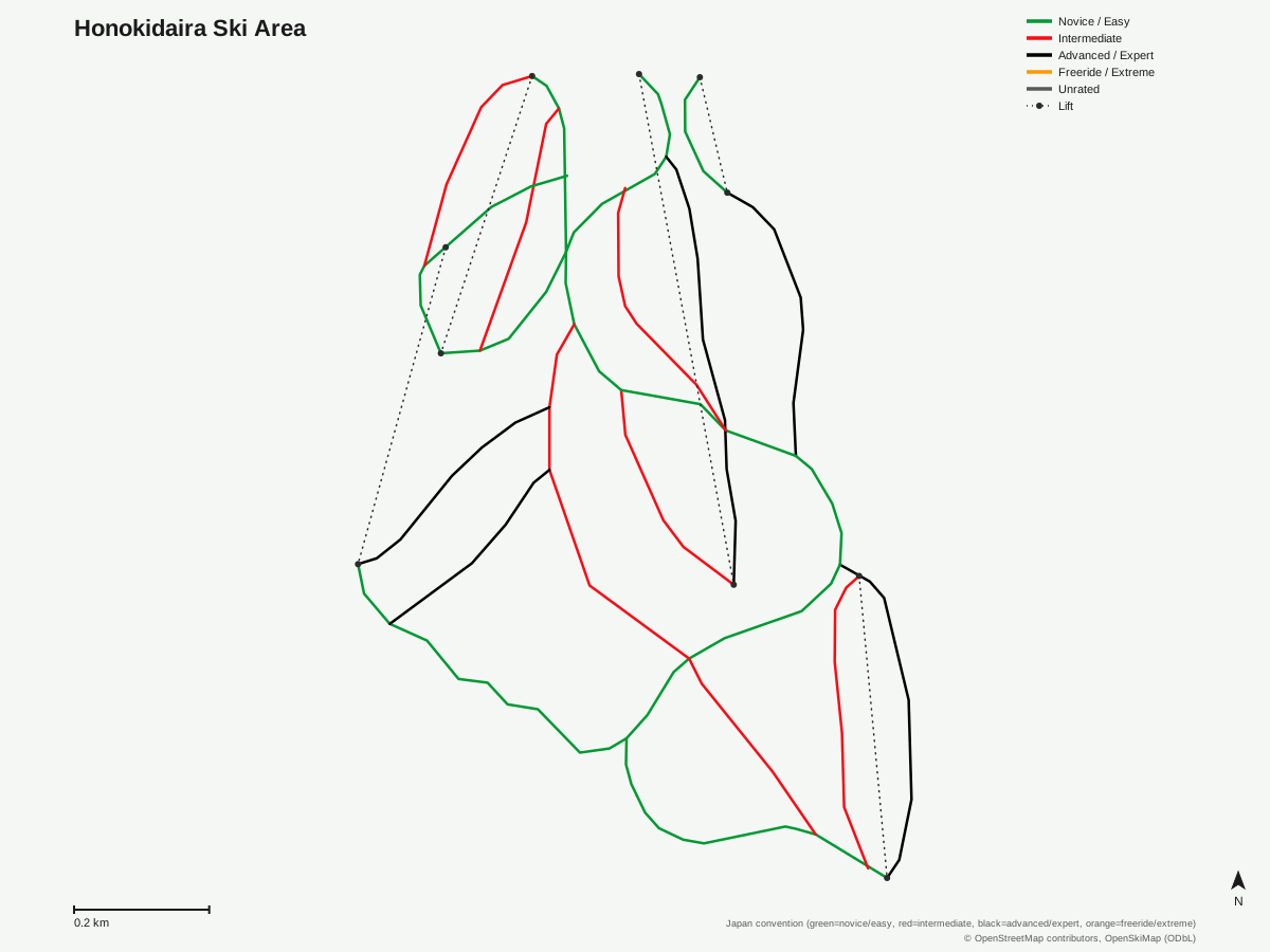
Honokidaira Ski Area: 16 runs, 5 lifts. Reflects OpenStreetMap's run and lift mapping for Honokidaira Ski Area, not the resort's own trail map graphic. © OpenStreetMap contributors, OpenSkiMap (ODbL).
Typical conditions by month
Monthly conditions data for Honokidaira Ski Area is not yet available.
Lift tickets & passes
Honokidaira Ski Area has no multi-resort pass affiliations on record.
Getting there
Nearest airports
- Shinshu-Matsumoto Airport (MMJ) — 38.7 km straight-line
- Toyama Kitokito Airport (TOY) — 59.8 km straight-line
- Komatsu Airport / JASDF Komatsu Air Base (KMQ) — 100.4 km straight-line
Nearest cities
- Matsumoto, Nagano — 43.2 km straight-line
- Toyama, Toyama — 63.9 km straight-line
- Ueda, Nagano — 75.4 km straight-line
Also covered by
Where to stay
A dedicated lodging guide for Honokidaira Ski Area is not yet available.
Nearby resorts
- Hida Takayama Municipal Ski Resort — 6 km straight-line, 226 m vertical
- Blue Resort Norikura — 12 km straight-line, 495.8 m vertical
- Shinshu-Matsumoto Nomugitoge Ski Resort — 25 km straight-line, 680.2 m vertical
- Hida Funayama Snow Resort Arkopia — 26 km straight-line, 401.7 m vertical
- Mont Deus Hida-kuraiyama Snow Park — 27 km straight-line, 263.3 m vertical
FAQ
- How big is Honokidaira Ski Area?
- Honokidaira sits between roughly 1,230.4m and 1,537.3m in elevation, a 306.9m vertical drop, with 16 runs covering 8.78km. Five chairlifts serve the mountain.
- Is Honokidaira Ski Area good for beginners?
- There's a decent easy share at 3.44km plus a small 0.2km novice section, though most of the terrain, 2.84km intermediate and 2.3km advanced, is aimed at skiers with some experience already.
- Where is Honokidaira Ski Area located?
- It's in Takayama, in Gifu Prefecture in the Japanese Alps, a region known for high-altitude powder snow rather than the coastal-influenced snowfall of Japan's Sea of Japan side resorts.
- What does Honokidaira Ski Area become in the off-season?
- The slopes convert into a sunflower garden once the lifts stop running for the year, a green-season use that takes advantage of the same high-elevation site.
- Which pass covers Honokidaira Ski Area?
- Honokidaira has no multi-resort pass affiliations on record; it's a direct-ticket resort rather than one bundled into Ikon, Epic, or Indy.
- What's the nearest airport to Honokidaira Ski Area?
- Shinshu-Matsumoto Airport (MMJ) is closest at about 38.7km, with Toyama Kitokito Airport (TOY) at 59.8km and Komatsu Airport (KMQ) — the resort's listed gateway — at 100.4km.
- Is Honokidaira Ski Area publicly supported?
- Yes — the resort receives supplementary funding from Gifu Prefecture, reflecting its role as regional winter infrastructure rather than a purely private commercial operation.
- How does Honokidaira's terrain break down by difficulty?
- Of the resort's 8.78km, 3.44km is easy, 2.84km intermediate, 2.3km advanced, and a small 0.2km is novice — a genuinely even three-way split across easy, intermediate, and advanced terrain rather than a mountain skewed heavily toward one level.
Data sources
Last verified: 2026-09-15
Base facts from OpenSkiMap (ODbL), OpenStreetMap contributors, Wikidata (CC0), OurAirports (public domain) and GeoNames (CC BY 4.0). See /data-sources/.