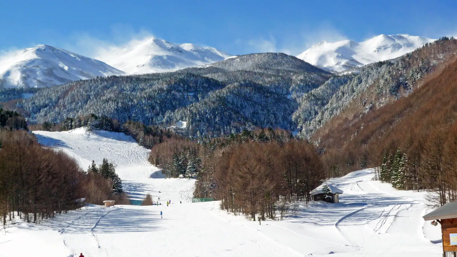
Blue Resort Norikura
Overview
Blue Resort Norikura is run by a company of the same purpose, Blue Resort Norikura Co., Ltd., set up in September 2011 with its headquarters at the resort itself in Matsumoto City, Nagano Prefecture. The mountain climbs 495.8 vertical meters from a 1,476.9-meter base to a 1,972.7-meter summit, with eight chairlifts, no gondolas or surface lifts in the mix, spread across 20 runs and 13.44 kilometers of terrain, including named lifts such as the Yamaboshi Lift, the Norikura Foothills Lift, the Yume-no-Taira Quad, and the Kamoshika Lift.
Terrain here favors newer skiers: 6.44 kilometers of easy runs is the largest category by a wide margin, well ahead of 4.57 kilometers of intermediate and 2.44 kilometers of advanced terrain. That beginner focus is reinforced by a dedicated kids’ area, Noriku Land, built specifically for younger skiers learning the sport, and it fits a mountain that markets itself as approachable rather than as a steep, expert-oriented destination.
One feature that sets Blue Resort Norikura apart from many similarly sized Japanese areas is backcountry access: the resort provides a route onto Mt. Norikura’s wider backcountry terrain and keeps its compressed-snow operations running into April specifically to support skiers using that access, extending the practical season well past when many comparable lift-served areas close for the year.
The resort belongs to the Hakuba Valley All-Mountain Pass network, which its pass partner advertises as unlimited access across all 10 Hakuba Valley ski areas on both day and season products, giving visitors a reason to base a trip in the region rather than treating Blue Resort Norikura as an isolated stop. Getting there is straightforward by regional standards: about 60 minutes by car from the Matsumoto Interchange on the Nagano Expressway, or 60 minutes by bus from Shin-Shimashima Station, with Shinshu-Matsumoto Airport just 29.1 kilometers away for anyone flying in.
Measured per lift and per run, Blue Resort Norikura reads as a mountain built for longer laps than many of its Hakuba Valley neighbors: average run length comes out to about 0.67 kilometers and vertical per lift to roughly 62 meters across the eight-chairlift system, both on the higher end for a resort this size. Combined with the beginner-leaning terrain split and the dedicated kids’ area, that suggests a mountain where even newer skiers get meaningfully long, gentle descents rather than short beginner loops, which likely factors into why the resort keeps its lifts running into April to support backcountry access on Mt. Norikura.
The resort’s own operating company, Blue Resort Norikura Co., Ltd., was set up specifically to run this single property when it was established in September 2011, a narrower corporate structure than the multi-resort operators common elsewhere in the ski industry. That single-property focus shows in the level of on-mountain detail the resort promotes, named lifts, a dedicated kids’ zone, and specific transit times from both the Matsumoto Interchange and Shin-Shimashima Station, the kind of granular access information a standalone operator has more reason to maintain than a company juggling a larger portfolio of ski areas across the Hakuba Valley. Between the eight-chairlift network, the 495.8-meter vertical, and the Hakuba Valley pass affiliation, Blue Resort Norikura offers a fuller package than its 20-run count alone would suggest to a visitor scanning past it toward the valley’s larger-name resorts.
Key stats
Official website — Last checked 2026-09-13
Lifts by type
| Type | Count |
|---|---|
| chair lift | 8 |
Runs by difficulty
| Difficulty | Distance |
|---|---|
| easy | 6.44 km |
| advanced | 2.44 km |
| intermediate | 4.57 km |
Maps
View official Blue Resort Norikura trail map (PDF) →
Run & lift overview
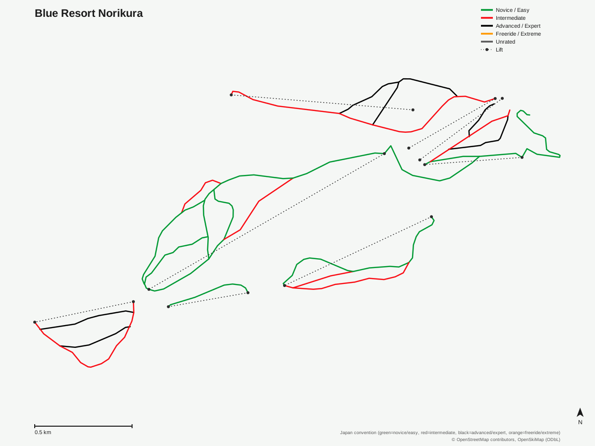
Blue Resort Norikura: 20 runs, 8 lifts. Drawn from OpenStreetMap run and lift data — not the official Blue Resort Norikura trail map. © OpenStreetMap contributors, OpenSkiMap (ODbL).
Typical conditions by month
Monthly conditions data for Blue Resort Norikura is not yet available.
Lift tickets & passes
Blue Resort Norikura has no multi-resort pass affiliations on record.
Getting there
Nearest airports
- Shinshu-Matsumoto Airport (MMJ) — 29.1 km straight-line
- Toyama Kitokito Airport (TOY) — 69.9 km straight-line
- Komatsu Airport / JASDF Komatsu Air Base (KMQ) — 111.7 km straight-line
Nearest cities
- Matsumoto, Nagano — 35 km straight-line
- Ueda, Nagano — 68.5 km straight-line
- Iida, Nagano — 69.2 km straight-line
Also covered by
Where to stay
A dedicated lodging guide for Blue Resort Norikura is not yet available.
Nearby resorts
- Honokidaira Ski Area — 12 km straight-line, 306.9 m vertical
- Shinshu-Matsumoto Nomugitoge Ski Resort — 13 km straight-line, 680.2 m vertical
- Hida Takayama Municipal Ski Resort — 15 km straight-line, 226 m vertical
- Kisofukushima Ski Resort — 20 km straight-line, 680.6 m vertical
- Yabuhara Kogen — 21 km straight-line, 552.1 m vertical
FAQ
- How big is Blue Resort Norikura?
- 495.8 vertical meters between a 1,972.7-meter summit and a 1,476.9-meter base, with 8 lifts, all chairlifts, serving 20 runs across 13.44 mapped kilometers.
- Who operates Blue Resort Norikura?
- Blue Resort Norikura Co., Ltd., a company established in September 2011 and headquartered at the resort in Matsumoto City, Nagano Prefecture.
- Which pass covers Blue Resort Norikura?
- The Hakuba Valley All-Mountain Pass, which the resort's pass partner describes as unlimited access across all 10 Hakuba Valley areas on both day-pass and season-pass products.
- Is Blue Resort Norikura good for beginners?
- Easy terrain leads at 6.44 kilometers, well ahead of 4.57 km intermediate and 2.44 km advanced, plus a dedicated Kids Park called Noriku Land, so the resort is built with newer skiers and families in mind.
- Does Blue Resort Norikura offer backcountry access?
- Yes, the resort provides access to backcountry terrain on Mt. Norikura, and it keeps compressed-snow operations running into April partly to support that backcountry use.
- How do you get to Blue Resort Norikura?
- By car it's about 60 minutes from Matsumoto Interchange on the Nagano Expressway, or about 60 minutes by bus from Shin-Shimashima Station.
- What's the nearest airport to Blue Resort Norikura?
- Shinshu-Matsumoto Airport, just 29.1 kilometers away, making it one of the more airport-convenient resorts in the Nagano ski region.
- How long is the average run at Blue Resort Norikura?
- 13.44 kilometers across 20 runs works out to roughly 0.67 kilometers per run, on the longer side for a resort of its size, with vertical per lift averaging about 62 meters across all eight chairlifts.
Data sources
Last verified: 2026-09-17
Base facts from OpenSkiMap (ODbL), OpenStreetMap contributors, Wikidata (CC0), OurAirports (public domain) and GeoNames (CC BY 4.0). See /data-sources/.