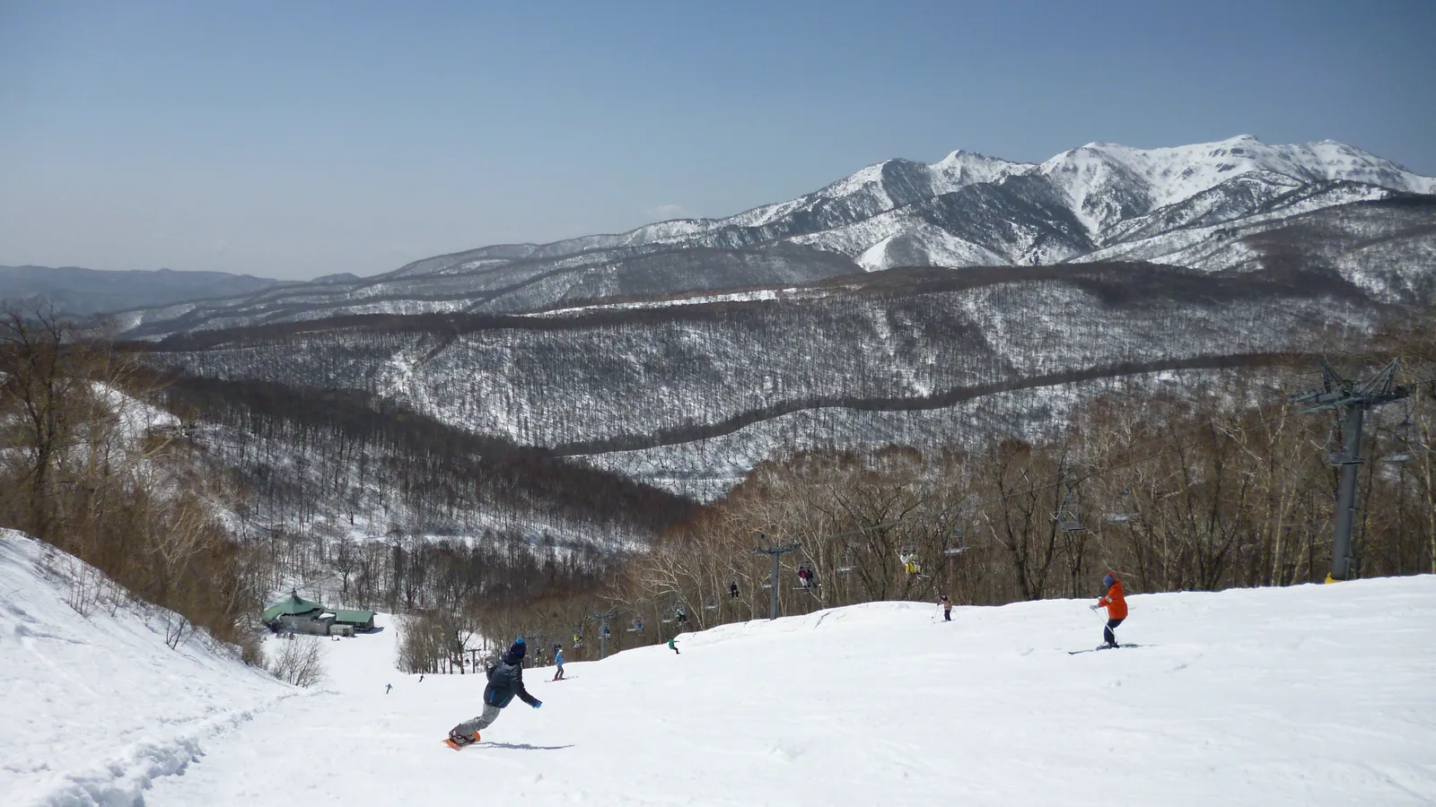
White World Oze Iwakura
Overview
Eleven lifts serving eleven runs is a ratio that stands out even within a group of resorts that already trends lift-dense: White World Oze Iwakura pairs one lift for almost every trail on the mountain, including a single gondola among the ten chairs. That’s a very different arrangement from, say, Tateyama Sanroku’s eight lifts over eleven runs or Ishiuchi Maruyama’s fourteen lifts spread across forty-one — here, each run appears to get comparatively dedicated service rather than sharing capacity across a wider network.
The resort’s base sits at 1,042.8 m, the second-highest starting elevation of any resort in this batch behind only Palcall Tsumagoi’s 1,386 m, climbing to a 1,673.4 m summit for a 630.6 m vertical drop. Despite that elevation, the trail network is compact — just 10.52 km combined across the 11 runs — and weighted toward intermediate skiing, with 7.26 km in that category against 2.5 km easy and a thin 0.76 km rated advanced.
The name references Oze, the highland wetland region straddling Gunma, Fukushima, Niigata, and Tochigi prefectures, best known nationally as a national park and summer hiking destination rather than for its winter terrain — a naming choice that ties the resort to the broader Oze area’s identity even though the ski area itself sits in Gunma Prefecture specifically.
Access runs through Gunma’s regional cities rather than any single nearby metropolis: Kiryū and Maebashi are essentially tied as the closest population centers, both around 48 km away, with Isesaki a little farther at 56 km. None of Japan’s three largest airports sits particularly close — Fukushima Airport, at about 117 km, is the nearest option, ahead of Niigata (126 km, also the resort’s recorded gateway) and Ibaraki (129 km) — making White World Oze Iwakura one of the more remote resorts in this group in terms of straight-line air access, despite its relatively central position within Honshu. No multi-resort pass covers the resort, and lift tickets are sold directly through its own site.
Set beside Palcall Tsumagoi, the only resort in this group with a higher base elevation, White World Oze Iwakura shares that same high-plateau character: both sit well above the 300-600 m base elevations typical of the Niigata coastal resorts, and both draw their names from the surrounding highland geography rather than a town or company. The practical difference is scale — Palcall Tsumagoi’s 15.45 km of trail and gondola access give it a modest edge in variety over White World Oze Iwakura’s more tightly packed 10.52 km, even though the two share a similar overall vertical drop.
The near-one-to-one lift-to-run ratio here means most of the resort’s 11.53 km of vertical relief is delivered through relatively few, well-defined trails rather than a maze of interconnecting cut-throughs, which tends to make route-finding straightforward for visitors on their first day. Combined with the high base elevation and intermediate-heavy terrain split, White World Oze Iwakura reads as a resort built for repeat, confident intermediate skiing on a handful of substantial runs rather than for exploration across a sprawling trail map, a profile that rewards skiers who value consistency over variety. None of the resort’s season-length or snowmaking coverage details are independently confirmed here, so visitors should verify current-season operating dates directly with the operator before planning a visit.
Key stats
Official website — Last checked 2026-09-13
Lifts by type
| Type | Count |
|---|---|
| gondola | 1 |
| chair lift | 10 |
Runs by difficulty
| Difficulty | Distance |
|---|---|
| easy | 2.5 km |
| advanced | 0.76 km |
| intermediate | 7.26 km |
Maps
View official White World Oze Iwakura trail map (PDF) →
Run & lift overview
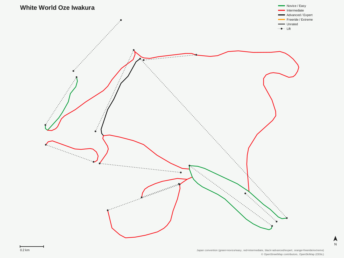
White World Oze Iwakura: 11 runs, 11 lifts. Generated from community-mapped OpenStreetMap data, not White World Oze Iwakura's official map artwork. © OpenStreetMap contributors, OpenSkiMap (ODbL).
Typical conditions by month
Monthly conditions data for White World Oze Iwakura is not yet available.
Lift tickets & passes
White World Oze Iwakura has no multi-resort pass affiliations on record.
Getting there
Nearest airports
- Fukushima Airport (FKS) — 117.4 km straight-line
- Niigata Airport (KIJ) — 126.4 km straight-line
- Ibaraki Airport (IBR) — 128.9 km straight-line
Nearest cities
- Kiryū, Gunma — 48 km straight-line
- Maebashi, Gunma — 48.1 km straight-line
- Isesaki, Gunma — 56 km straight-line
Also covered by
Where to stay
A dedicated lodging guide for White World Oze Iwakura is not yet available.
Nearby resorts
- Katashina Kogen Ski Resort — 2 km straight-line, 313 m vertical
- Katashina Ogna Hotaka Snow Resort — 3 km straight-line, 362.2 m vertical
- Snow Park Oze Tokura — 5 km straight-line, 314.4 m vertical
- Oguna Hotaka Ski Area — 6 km straight-line, 560.2 m vertical
- Kawaba Ski Resort — 9 km straight-line, 555.1 m vertical
FAQ
- How big is White World Oze Iwakura?
- White World Oze Iwakura has a 630.6 m vertical drop from a 1,042.8 m base to a 1,673.4 m summit — the second-highest base elevation of any resort in this batch — but a compact 11 runs totaling 10.52 km.
- How many lifts does White World Oze Iwakura have?
- Eleven lifts, including one gondola, serve the resort's 11 runs — a rare near-one-to-one ratio of lifts to trails.
- Is White World Oze Iwakura good for intermediate skiers?
- Yes — 7.26 km of the resort's 10.52 km total is rated intermediate, well ahead of 2.5 km easy and just 0.76 km advanced.
- Which pass covers White World Oze Iwakura?
- White World Oze Iwakura has no multi-resort pass listed in its resort record, so lift tickets are handled directly through the resort's own booking channels.
- What's the nearest airport to White World Oze Iwakura?
- Fukushima Airport is closest at about 117 km, with Niigata Airport (126 km) and Ibaraki Airport (129 km) as more distant alternatives.
- What's the nearest city to White World Oze Iwakura?
- Kiryū and Maebashi, both in Gunma Prefecture, are essentially tied as the closest cities at around 48 km.
- Is White World Oze Iwakura good for beginners?
- The terrain leans intermediate rather than beginner — 7.26 km of the resort's 10.52 km total is intermediate-rated, with only 2.5 km classed easy, so newer skiers may find fewer dedicated gentle runs here than at some nearby Gunma resorts.
- How does White World Oze Iwakura compare to Palcall Tsumagoi for elevation?
- Palcall Tsumagoi's 1,386 m base is higher, but White World Oze Iwakura's 1,042.8 m base still ranks second-highest among the resorts covered in this group.
Data sources
Last verified: 2026-09-15
Base facts from OpenSkiMap (ODbL), OpenStreetMap contributors, Wikidata (CC0), OurAirports (public domain) and GeoNames (CC BY 4.0). See /data-sources/.