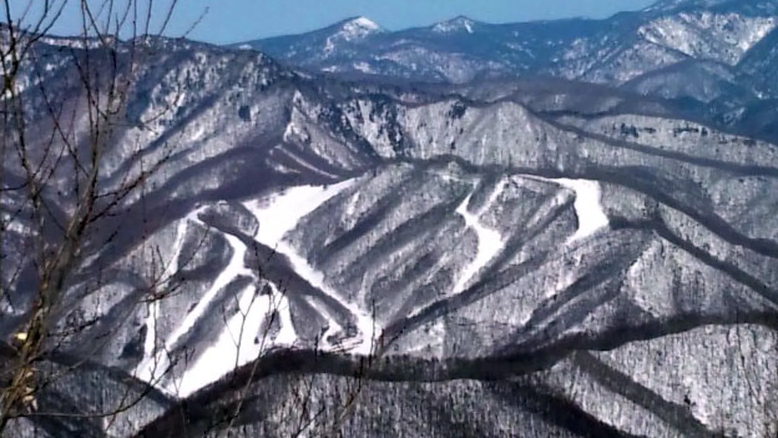
Snow Park Oze Tokura
Overview
Snow Park Oze Tokura sits in Gunma Prefecture, roughly 150km northwest of Tokyo and about an hour’s drive from the Numata interchange, close enough to the capital for a day trip but built with a rural, natural-terrain character rather than a resort-town polish. The resort leans hard on its snow quality as the selling point, describing conditions as light, dry powder comparable to Hokkaido’s — a notable claim for a mountain this far south and inland — with roughly 2 meters of snowfall in an average season.
The terrain itself is modest in scale: 9 runs across 6.1km, rising 314.4m from a 1,077.3m base to a 1,391.7m summit, served entirely by chairlifts, six of them, with no surface lifts in the mix. Rather than grooming everything into uniform corduroy, Snow Park Oze Tokura keeps some of its signature terrain closer to its natural state — the Romance Course runs past steep natural walls, and the Arase Course is left ungroomed, with the mountain’s own undulations standing in for shaped features. For skiers wanting more of that untouched snow, the resort runs guided snowcat tours it brands as Gelatine Powder Guide trips into backcountry-adjacent terrain. Beginners get 2.4km of easy runs kept apart from the rest of the mountain, while most of the remaining terrain, 2.65km, sits at intermediate, plus 1.05km advanced.
The Oze Kogen Hotel sits directly slopeside, and the resort emphasizes safe access in winter — no steep mountain passes or exposed roads on the approach, a real consideration in a snowy region. Outside of winter, the site converts into Green Park Oze Tokura, a camping ground that takes advantage of the elevation’s cooler summer temperatures. There’s no multi-resort pass affiliation here, so a ticket is a direct purchase. Fukushima Airport is the closest airport at about 113.3km, though the resort’s listed gateway, Niigata Airport, is a little farther at 123.2km, with the Gunma cities of Kiryū, Maebashi, and Isesaki all within roughly an hour’s drive.
Broken down by share of the mountain, roughly 39% of Snow Park Oze Tokura’s terrain is easy, 43% intermediate, and 17% advanced — a split that puts the resort’s center of gravity squarely in the intermediate range while still reserving a real advanced pocket, largely on the natural-walled Romance Course, for stronger skiers. That’s a slightly different balance than many of its Gunma neighbors, several of which lean further toward beginner terrain, and it fits with the resort’s own marketing around natural, ungroomed features like the Arase Course rather than a purely manicured, family-first layout.
Six lifts serving nine runs across 6.1km works out to roughly 1.5 runs per lift and just over a kilometer of terrain per lift — a tight, efficient layout for a resort whose appeal rests more on snow quality and natural terrain features than on sheer trail count. For skiers weighing this resort against its Gunma neighbors, that combination of a compact lift network and a genuinely large advanced pocket relative to its overall size is probably the more useful comparison than run count alone.
Key stats
Official website — Last checked 2026-09-13
Lifts by type
| Type | Count |
|---|---|
| chair lift | 6 |
Runs by difficulty
| Difficulty | Distance |
|---|---|
| easy | 2.4 km |
| advanced | 1.05 km |
| intermediate | 2.65 km |
Maps
View official Snow Park Oze Tokura trail map (page) →
Run & lift overview
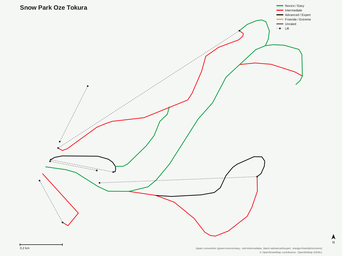
Snow Park Oze Tokura: 9 runs, 6 lifts. Drawn from OpenStreetMap run and lift data — not the official Snow Park Oze Tokura trail map. © OpenStreetMap contributors, OpenSkiMap (ODbL).
Typical conditions by month
Monthly conditions data for Snow Park Oze Tokura is not yet available.
Lift tickets & passes
Snow Park Oze Tokura has no multi-resort pass affiliations on record.
Getting there
Nearest airports
- Fukushima Airport (FKS) — 113.3 km straight-line
- Niigata Airport (KIJ) — 123.2 km straight-line
- Ibaraki Airport (IBR) — 128.4 km straight-line
Nearest cities
- Kiryū, Gunma — 50.8 km straight-line
- Maebashi, Gunma — 52.2 km straight-line
- Isesaki, Gunma — 59.6 km straight-line
Also covered by
Where to stay
A dedicated lodging guide for Snow Park Oze Tokura is not yet available.
Nearby resorts
- Katashina Kogen Ski Resort — 5 km straight-line, 313 m vertical
- White World Oze Iwakura — 5 km straight-line, 630.6 m vertical
- Katashina Ogna Hotaka Snow Resort — 7 km straight-line, 362.2 m vertical
- Marunuma Kogen Ski Resort — 10 km straight-line, 607.7 m vertical
- Oguna Hotaka Ski Area — 10 km straight-line, 560.2 m vertical
FAQ
- How big is Snow Park Oze Tokura?
- Snow Park Oze Tokura has a 1,077.3m base and a 1,391.7m summit, a 314.4m vertical drop, with 9 runs covering 6.1km. All 6 lifts on the mountain are chairlifts.
- Is Snow Park Oze Tokura good for beginners?
- There's a dedicated beginner course kept separate from the rest of the mountain, and 2.4km of the resort's 6.1km is rated easy, though most of the terrain, 2.65km, sits at intermediate.
- What's the snow like at Snow Park Oze Tokura?
- The resort markets its snow quality as light powder comparable to Hokkaido's, with around 2 meters of accumulation in a typical season, and runs backcountry snowcat tours it calls Gelatine Powder Guide tours for skiers chasing untracked terrain.
- What are the signature runs at Snow Park Oze Tokura?
- The Romance Course features steep natural walls, while the Arase Course is left ungroomed with natural undulations rather than machine-shaped terrain — both are built around the mountain's natural contours instead of manicured grooming.
- How do you get to Snow Park Oze Tokura?
- It's about an hour's drive from the Numata interchange on the expressway, with free parking for roughly 900 vehicles, or reachable by bus or train from major stations in the region.
- Which pass covers Snow Park Oze Tokura?
- Snow Park Oze Tokura has no multi-resort pass affiliations on record; lift access is sold directly through the resort.
- What's the nearest airport to Snow Park Oze Tokura?
- Fukushima Airport (FKS) is closest at about 113.3km, with Niigata Airport (KIJ) — also the resort's listed gateway — at 123.2km and Ibaraki Airport (IBR) at 128.4km.
- How does Snow Park Oze Tokura's terrain split by difficulty?
- Of the resort's 6.1km, 2.4km is easy, 2.65km intermediate, and 1.05km advanced — roughly 39% easy, 43% intermediate, and 17% advanced, a mix weighted toward accessible skiing with a real advanced pocket on the Romance Course.
Data sources
Last verified: 2026-09-15
Base facts from OpenSkiMap (ODbL), OpenStreetMap contributors, Wikidata (CC0), OurAirports (public domain) and GeoNames (CC BY 4.0). See /data-sources/.