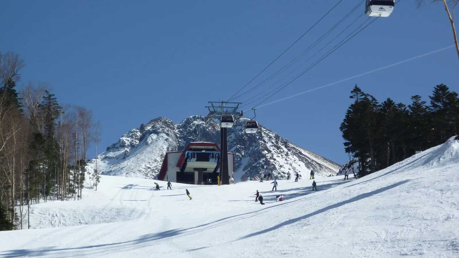
Marunuma Kogen Ski Resort
Overview
Marunuma Kogen sits inside Nikko National Park in Katashina Village, a mountain community in Gunma Prefecture’s Tone District. The resort’s base sits at 1,383.1 meters, already higher than the summit of most Japanese ski areas, and the top station reaches 1,990.8 meters, giving a vertical drop of 607.7 meters — enough that the resort markets its scenery around the 2,000-meter mark. Eight lifts, including a single gondola and seven chairlifts, move skiers across 17 runs totaling 10.22 kilometers of piste. The mix leans balanced rather than beginner-heavy: about 4.53 km (44%) is rated easy, 4.46 km (44%) intermediate, and 0.85 km (8%) advanced, with a further 0.39 km classed as other terrain such as connector or park runs. That even split between green and blue-rated terrain is unusual for a resort this size, pointing to a mountain built more for progression skiing than for beginners parking on one gentle slope all day.
Access runs through central Honshu’s regional airports rather than a single hub. Ibaraki Airport, 118.6 km away, is the nearest sizeable gateway, with Fukushima Airport (107.1 km) actually closer as the crow flies and Niigata Airport (128.8 km) also within range. By road, the resort’s own site cites roughly two and a half hours from the Nerima interchange in Tokyo. The closer population centers are Kiryū (45.7 km, population 108,991), Maebashi (51.2 km, population 332,149), and Ashikaga (53.9 km, population 144,746), all in the Gunma-Tochigi border area.
On the mountain, Marunuma pairs its ski terrain with a snow park and a dedicated kids’ area, and the base includes a day-use hot spring facility at Center Station along with on-site lodging at Chalet Marunuma. There’s no sign in the resort’s pass data of Ikon, Epic, or Indy participation, so lift access here runs on standalone day and season tickets rather than a multi-mountain pass. Outside the ski season, the same lift infrastructure supports green-season sightseeing within the national park, a sign that Marunuma’s elevation and setting draw visitors well beyond the winter months.
Run by run, Marunuma’s 17 pistes average out to roughly 600 meters each across the 10.22 km total, short relative to the mountain’s 607.7-meter vertical, since most of the marked terrain traverses the slope above and below Center Station rather than dropping straight down the fall line. The eight-lift network is built around a single gondola with seven supporting chairlifts, which works out to about 1.3 kilometers of piste per lift, a denser lift-to-terrain ratio than many larger Honshu resorts carry and one that reflects Marunuma’s compact, contour-hugging trail layout rather than long point-to-point descents. Base elevation alone puts Marunuma above the summit height of a number of lower-lying Japanese ski areas, a product of building lift infrastructure this high inside a national park boundary. Set against Iwappara and Kamui Ski Links, two similarly sized Japanese resorts covered elsewhere on this site, Marunuma’s vertical drop is comparable, but its base elevation of 1,383 meters is far higher than either, and its lift count of eight is the largest of the three despite a smaller total run distance than Kamui’s.
Key stats
Official website — Last checked 2026-09-13
Lifts by type
| Type | Count |
|---|---|
| gondola | 1 |
| chair lift | 7 |
Runs by difficulty
| Difficulty | Distance |
|---|---|
| easy | 4.53 km |
| other | 0.39 km |
| advanced | 0.85 km |
| intermediate | 4.46 km |
Maps
View official Marunuma Kogen Ski Resort trail map (PDF) →
Run & lift overview
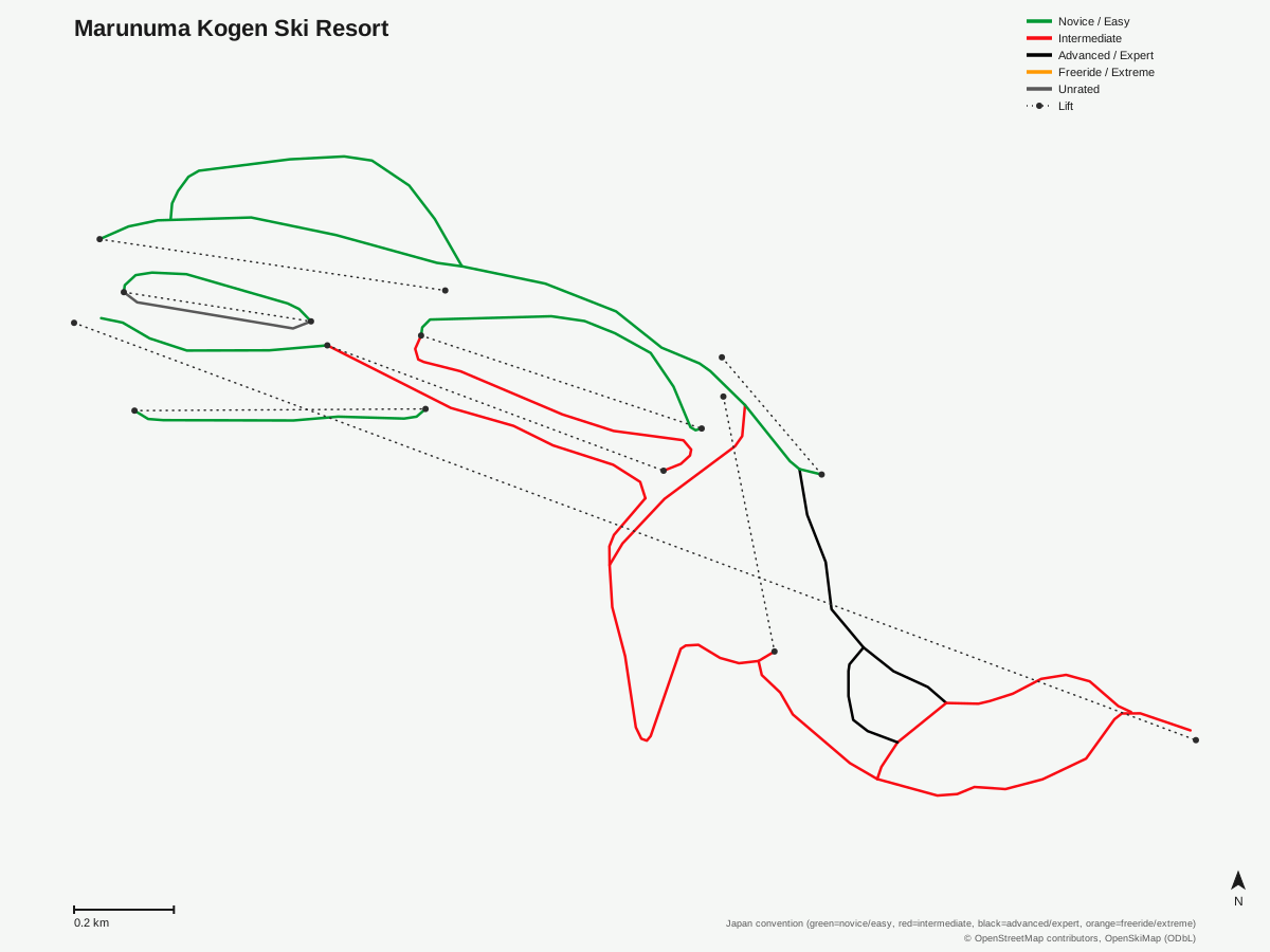
Marunuma Kogen Ski Resort: 17 runs, 8 lifts. Reflects OpenStreetMap's run and lift mapping for Marunuma Kogen Ski Resort, not the resort's own trail map graphic. © OpenStreetMap contributors, OpenSkiMap (ODbL).
Typical conditions by month
Monthly conditions data for Marunuma Kogen Ski Resort is not yet available.
Lift tickets & passes
Marunuma Kogen Ski Resort has no multi-resort pass affiliations on record.
Getting there
Nearest airports
- Fukushima Airport (FKS) — 107.1 km straight-line
- Ibaraki Airport (IBR) — 118.6 km straight-line
- Niigata Airport (KIJ) — 128.8 km straight-line
Nearest cities
- Kiryū, Gunma — 45.7 km straight-line
- Maebashi, Gunma — 51.2 km straight-line
- Ashikaga, Tochigi — 53.9 km straight-line
Also covered by
Where to stay
A dedicated lodging guide for Marunuma Kogen Ski Resort is not yet available.
Nearby resorts
- Snow Park Oze Tokura — 10 km straight-line, 314.4 m vertical
- Katashina Kogen Ski Resort — 11 km straight-line, 313 m vertical
- White World Oze Iwakura — 12 km straight-line, 630.6 m vertical
- Katashina Ogna Hotaka Snow Resort — 14 km straight-line, 362.2 m vertical
- Oguna Hotaka Ski Area — 16 km straight-line, 560.2 m vertical
FAQ
- How high is Marunuma Kogen Ski Resort, and what's the vertical drop?
- The base sits at 1,383.1 meters and the top station at 1,990.8 meters, giving a vertical drop of 607.7 meters, one of the more substantial verticals among Gunma's ski areas.
- How many lifts and runs are at Marunuma Kogen?
- Eight lifts, one gondola and seven chairlifts, serve 17 runs spread across 10.22 km of marked piste.
- Is Marunuma Kogen better suited to beginners or intermediates?
- The terrain splits almost evenly between easy (4.53 km, about 44%) and intermediate (4.46 km, about 44%) runs, with only 0.85 km rated advanced, so it favors skiers moving from green to blue terrain rather than absolute beginners or expert-only lines.
- Where exactly is Marunuma Kogen located?
- It's in Katashina Village, Tone District, Gunma Prefecture, within the boundaries of Nikko National Park.
- What's the nearest airport to Marunuma Kogen?
- Ibaraki Airport is the closest sizeable gateway at 118.6 km, though Fukushima Airport (107.1 km) is nearer in straight-line distance; Niigata Airport (128.8 km) is a third option.
- Does Marunuma Kogen accept Ikon, Epic, or Indy Pass?
- Marunuma Kogen isn't currently listed as a partner resort on Ikon, Epic, or Indy; visitors buy lift tickets directly from the resort.
- How long are the average runs at Marunuma Kogen?
- With 17 runs spread across 10.22 km, the average run works out to roughly 600 meters, short relative to the mountain's 607.7-meter vertical drop, since most marked pistes traverse the slope above and below Center Station rather than descending the full mountain in one continuous line.
- How is Marunuma Kogen's lift network arranged?
- Eight lifts in total, but only one gondola; the other seven are chairlifts, which carry the bulk of uphill capacity across a piste network that works out to roughly 1.3 kilometers of trail per lift.
Data sources
Last verified: 2026-09-15
Base facts from OpenSkiMap (ODbL), OpenStreetMap contributors, Wikidata (CC0), OurAirports (public domain) and GeoNames (CC BY 4.0). See /data-sources/.