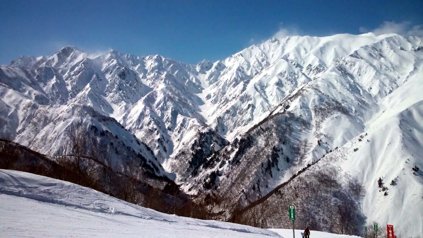
Hakuba 47
Overview
Hakuba 47 is a small resort by run count relative to its neighbors in the Hakuba Valley, but its vertical statistics don’t read that way: 819.8 m of drop, from an 819.6 m base to a 1,639.4 m summit, is close to what much larger resorts in the valley offer, packed onto just 13 marked runs and 12.74 km of terrain. Six lifts do the work here — a gondola and five chairlifts — a lean setup that reflects the resort’s role as one piece of a larger connected system rather than a self-contained destination. Notably absent from that lift roster is any drag lift, t-bar, or magic carpet: unlike some of its Hakuba Valley neighbors, Hakuba 47’s beginner and children’s courses run entirely off the chairlifts and groomed easy terrain rather than a dedicated learner conveyor, which makes the resort’s already lean six-lift network cover its full 819.8 m of vertical with just two lift types.
That connection matters more than the standalone numbers suggest. Hakuba 47’s own marketing pairs it directly with neighboring Hakuba Goryu, describing the combined terrain as suited to skiers from advanced levels down to beginners and children, and both areas sit under the umbrella of the Hakuba Valley All-Mountain Pass, which covers all 10 linked ski areas in the valley on one ticket, sold as both a day pass and a season pass. Skiers rarely think of Hakuba 47 in isolation because the lift network doesn’t ask them to. That combination — a modest 13-run count paired with a substantial 819.8 m vertical drop — is part of why visitors typically fold Hakuba 47 into a broader Hakuba Valley itinerary on the All-Mountain Pass rather than treating it as a standalone day’s destination.
Within its own boundary, the easy-terrain share is substantial for a resort this size: 8.06 km of the 12.74 km total is rated easy, against 3.89 km intermediate and just 0.79 km advanced on the marked map. The operator leans on that base with beginner- and family-oriented course descriptions, while separately promoting a dedicated snow park that it describes as incorporating current terrain-park trends and receiving regular upkeep — enough of a freestyle focus that Hakuba 47 has built something of an identity around park skiing within the wider valley, even though its groomed-run difficulty split skews toward easier terrain rather than steep lines. The resort’s site also foregrounds snow quality and snowfall volume as Hakuba’s broader regional draw, a claim that applies to the valley as a whole rather than to Hakuba 47 specifically.
Getting there means routing through one of two similarly distant regional airports — Toyama Kitokito, 56.8 km away, and Shinshu-Matsumoto, 57.4 km — though Komatsu Airport, 130.4 km out, is the resort’s designated gateway thanks to fuller flight schedules. Nagano city, population around 373,000, sits closer at 32.3 km and functions as the more common rail staging point before the final leg into the valley. Two more Nagano Prefecture cities sit within roughly an hour’s drive of the resort: Matsumoto, home to the Shinshu-Matsumoto Airport and a city in its own right of about 241,000 people, is 50.9 km away, and Ueda, with roughly 157,000 residents, is a comparable 51.1 km out — both close enough that skiers based in either city could reasonably day-trip into the valley rather than staying overnight near the resort.
Key stats
Official website — Last checked 2026-09-14
Lifts by type
| Type | Count |
|---|---|
| gondola | 1 |
| chair lift | 5 |
Runs by difficulty
| Difficulty | Distance |
|---|---|
| easy | 8.06 km |
| advanced | 0.79 km |
| intermediate | 3.89 km |
Maps
View official Hakuba 47 trail map (PDF) →
Run & lift overview
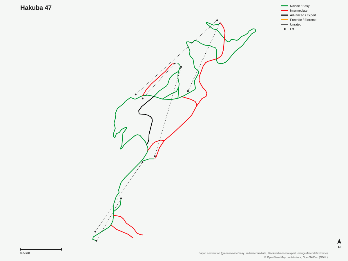
Hakuba 47: 13 runs, 6 lifts. Drawn from OpenStreetMap run and lift data — not the official Hakuba 47 trail map. © OpenStreetMap contributors, OpenSkiMap (ODbL).
Typical conditions by month
Monthly conditions data for Hakuba 47 is not yet available.
Lift tickets & passes
- Epic Pass — One complimentary 5-day Hakuba Valley ticket (all 10 areas), consecutive days from first use (shuttle-only use counts; 10 days total combined with Rusutsu); no blackout dates; excludes night skiing and night shuttles
- Epic Local Pass — One complimentary 5-day Hakuba Valley ticket (all 10 areas), consecutive days from first use (shuttle-only use counts; 10 days total combined with Rusutsu); no blackout dates; excludes night skiing and night shuttles
- Hakuba Valley All-Mountain Pass — Unlimited across all 10 Hakuba Valley areas (day pass and season pass products both cover all 10)
Getting there
Nearest airports
- Toyama Kitokito Airport (TOY) — 56.8 km straight-line
- Shinshu-Matsumoto Airport (MMJ) — 57.4 km straight-line
- Noto Satoyama Airport (NTQ) — 102.7 km straight-line
Nearest cities
- Nagano, Nagano — 32.3 km straight-line
- Matsumoto, Nagano — 50.9 km straight-line
- Ueda, Nagano — 51.1 km straight-line
Also covered by
Where to stay
A dedicated lodging guide for Hakuba 47 is not yet available.
Nearby resorts
- Hakuba Goryu — 1 km straight-line, 886.7 m vertical
- Hakuba Happo One — 3 km straight-line, 1076.8 m vertical
- Hakuba Iwatake — 6 km straight-line, 536.5 m vertical
- Hakuba Sanosaka Snow Resort — 6 km straight-line, 355 m vertical
- Kashimayari Snow Resort — 8 km straight-line, 491.6 m vertical
FAQ
- How big is Hakuba 47?
- Hakuba 47 has 13 runs totaling 12.74 km, with a vertical drop of 819.8 m from an 819.6 m base to a 1,639.4 m summit in Nagano Prefecture. It's a compact resort by run count, served by 6 lifts — a gondola and 5 chairlifts — but the vertical drop is comparable to much larger neighboring resorts.
- Is Hakuba 47 connected to Hakuba Goryu?
- Yes. The resort's own marketing describes Hakuba47 and Hakuba Goryu together as a combined terrain offering, and both are covered together under the Hakuba Valley All-Mountain Pass, so skiers typically treat the two as one connected ski area rather than separate destinations.
- Is Hakuba 47 good for beginners?
- There's a solid easy-terrain base for its size — 8.06 km of the resort's 12.74 km total is rated easy — and the operator specifically markets courses aimed at beginners and children alongside more advanced terrain, so first-timers aren't limited to a token slope.
- Does Hakuba 47 have a terrain park?
- Yes, the resort operates a dedicated snow park that it describes as incorporating current park-riding trends and receiving regular maintenance, distinguishing Hakuba 47 within the Hakuba Valley as one of the areas more focused on freestyle terrain.
- Which pass covers Hakuba 47?
- The Hakuba Valley All-Mountain Pass covers Hakuba 47 along with all 10 linked areas in the Hakuba Valley, sold as both a day pass and a season pass, so a single pass gives access to the whole valley rather than just this one resort.
- What's the nearest airport to Hakuba 47?
- Toyama Kitokito Airport (TOY) is closest at 56.8 km, with Shinshu-Matsumoto Airport (MMJ) close behind at 57.4 km. The resort's designated gateway is Komatsu Airport, 130.4 km away, farther than either regional option but with more scheduled service.
- How close is Hakuba 47 to Nagano city?
- Nagano, a city of roughly 373,000 people, is 32.3 km from the resort, making it the nearest major population center and a common staging point for travelers arriving by train before continuing to the Hakuba Valley.
- Is there a fourth airport option near Hakuba 47?
- Noto Satoyama Airport (NTQ), near Wajima on the Noto Peninsula, is a fourth regional option at 102.7 km — farther than Toyama Kitokito or Shinshu-Matsumoto and with a smaller scheduled flight network, so it sees less traffic from ski travelers than the closer two airports or the Komatsu gateway.
Data sources
Last verified: 2026-09-15
Base facts from OpenSkiMap (ODbL), OpenStreetMap contributors, Wikidata (CC0), OurAirports (public domain) and GeoNames (CC BY 4.0). See /data-sources/.