
Fox Peak Ski Area
Overview
Fox Peak is a small, community-operated ski area in the hills above Fairlie in South Canterbury, and everything about it reflects that scale: five lifts, all rope tows and drag lifts, serve just five marked runs adding up to under a kilometre and a half of trail. That’s a fraction of what a commercial resort offers, but the number understates what’s actually skiable — Fox Peak sits at the edge of a considerable amount of accessible backcountry terrain, and touring beyond the lift network is a normal part of a day here rather than an exception, provided visitors are carrying the avalanche safety gear the field expects for anyone heading out of bounds and paying the separate touring pass fee that helps fund track maintenance.
The vertical drop, 520 m from a 1,323 m base to 1,843 m at the top, is respectable for a field this size — actually larger than the vertical drop at several much bigger commercial resorts elsewhere in this guide, a reminder that lift count and terrain size don’t always track with elevation gain. The terrain splits fairly evenly across the difficulty bands given how little of it is groomed. What Fox Peak sells is less about infrastructure and more about the absence of crowds: no lift lines, no packed car parks, and a field run by and for a community rather than built to maximise throughput. Fox Lodge, on site, sleeps around 40 people, making an overnight stay a genuine option instead of requiring a daily drive up from Fairlie.
Operating hours are limited to weekends through the season, roughly July to October, and conditions dictate a lot of what’s actually open on any given day — this is not a resort with heavy snowmaking to smooth over a thin natural base, so a phone call or website check before driving up is worthwhile. That trade-off, less certainty in exchange for quiet slopes and a lower-key atmosphere, is the whole appeal for the skiers who return to Fox Peak year after year rather than driving further to a bigger commercial field like Mount Hutt or Porters.
The closest airport is the small Timaru Airport, about 60 km away, though Christchurch International Airport, roughly 144 km by road, is the realistic option for most visitors flying in from further afield, with Christchurch itself the nearest city of any size and Dunedin a considerably longer drive south.
Because Fox Peak has no snowmaking and a short lift network, a trip here works best for visitors who can be flexible about timing and are chasing the experience of a genuinely community-run field rather than guaranteed groomed corduroy every day. The nearby town of Fairlie is the practical staging point for supplies and fuel before heading up, since there’s little in the way of services at the ski area itself beyond Fox Lodge and the basic day facilities the club maintains. That simplicity, paired with the backcountry access on offer, is what distinguishes Fox Peak from the more commercially developed fields elsewhere in Canterbury and further south toward Queenstown.
Key stats
Official website — Last checked 2026-09-13
Lifts by type
| Type | Count |
|---|---|
| rope tow | 1 |
| drag lift | 4 |
Runs by difficulty
| Difficulty | Distance |
|---|---|
| easy | 0.51 km |
| novice | 0.07 km |
| advanced | 0.58 km |
| intermediate | 0.23 km |
Maps
View official Fox Peak Ski Area trail map (PDF) →
Run & lift overview
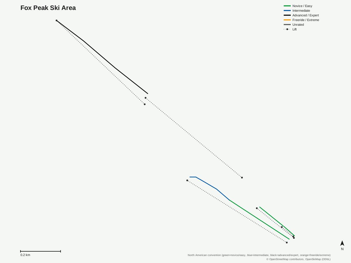
Fox Peak Ski Area: 5 runs, 5 lifts. A schematic built from OpenStreetMap/OpenSkiMap data — this is not Fox Peak Ski Area's official trail map. © OpenStreetMap contributors, OpenSkiMap (ODbL).
Typical conditions by month
Monthly conditions data for Fox Peak Ski Area is not yet available.
Lift tickets & passes
Fox Peak Ski Area has no multi-resort pass affiliations on record.
Getting there
Nearest airports
- Timaru Airport (TIU) — 60 km straight-line
- Hokitika Airfield (HKK) — 127.5 km straight-line
- Christchurch International Airport (CHC) — 144.3 km straight-line
Nearest cities
- Christchurch, Canterbury — 150.9 km straight-line
- Dunedin, Otago — 226 km straight-line
- Wellington, Wellington Region — 432.2 km straight-line
Where to stay
A dedicated lodging guide for Fox Peak Ski Area is not yet available.
Nearby resorts
- Roundhill Ski Field — 12 km straight-line, 754.9 m vertical
- Mount Dobson Ski Field — 15 km straight-line, 297.6 m vertical
- Mount Hutt Ski Area — 71 km straight-line, 645.8 m vertical
- Ōhau Snow Fields — 92 km straight-line, 380.5 m vertical
- Porters Ski Area — 93 km straight-line, 638.7 m vertical
FAQ
- How big is Fox Peak Ski Area?
- It's one of the smallest fields in this guide — five lifts (a rope tow and four drag lifts) serving five mapped runs and just 1.39 km of marked trail, though the surrounding backcountry terrain is much larger than the groomed footprint suggests.
- Is Fox Peak good for beginners?
- The lower slopes are gentle and the field is uncrowded, but it's a community-run operation with limited grooming compared to commercial resorts, so first-timers should expect a more basic setup than at a place like Mount Hutt or Porters.
- Does Fox Peak have backcountry skiing?
- Yes, and it's a significant part of the field's appeal — touring beyond the lift-served area is common, though the ski area asks visitors heading out of bounds to carry a probe, shovel, transceiver and personal locator beacon, and sells a separate touring pass for that access.
- What's the vertical drop at Fox Peak?
- 520 m, from a base of 1,323 m to a top of 1,843 m, which is a solid drop for a field with so few lifts — bigger, in fact, than the vertical at several much larger commercial resorts in this guide, including Coronet Peak and Mount Buller.
- Is Fox Peak a club field?
- It's community-operated rather than run for profit, in the same tradition as Canterbury's other club fields like Broken River and Mount Olympus, and it emphasises being uncrowded and low-key over lift infrastructure or grooming.
- What's the nearest airport to Fox Peak?
- Timaru Airport, about 60 km away, is closest, though Christchurch International Airport, roughly 144 km away, is the more likely arrival point for most visitors flying in from further afield.
- Does Fox Peak have on-mountain accommodation?
- Yes, Fox Lodge sleeps around 40 people, giving visitors the option to stay on site rather than commuting from Fairlie or further afield each day.
- When does Fox Peak operate?
- It runs weekends through the winter season, roughly July to October, with hours and terrain availability shaped heavily by natural snow conditions rather than a fixed commercial schedule.
Data sources
Last verified: 2026-09-15
Base facts from OpenSkiMap (ODbL), OpenStreetMap contributors, Wikidata (CC0), OurAirports (public domain) and GeoNames (CC BY 4.0). See /data-sources/.