Roundhill Ski Field
Overview
Key stats
Official website — Last checked 2026-09-13
Base elevation1365.1 m
Top elevation2120 m
Vertical drop754.9 m
Lifts4
Runs10
Total run distance8.79 km
Lifts by type
| Type | Count |
|---|---|
| t-bar | 2 |
| platter | 1 |
| rope tow | 1 |
Runs by difficulty
| Difficulty | Distance |
|---|---|
| easy | 1.07 km |
| advanced | 2.87 km |
| intermediate | 4.85 km |
Maps
View official Roundhill Ski Field trail map (PDF) →
Run & lift overview
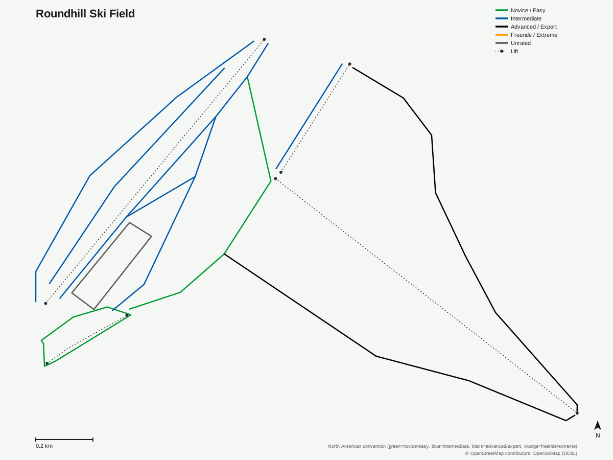
Roundhill Ski Field: 12 runs, 4 lifts. Generated from community-mapped OpenStreetMap data, not Roundhill Ski Field's official map artwork. © OpenStreetMap contributors, OpenSkiMap (ODbL).
Getting there
Nearest airports
- Timaru Airport (TIU) — 69.4 km straight-line
- Hokitika Airfield (HKK) — 126 km straight-line
- Wanaka Airport (WKA) — 151.1 km straight-line
Nearest cities
- Christchurch, Canterbury — 161.2 km straight-line
- Dunedin, Otago — 228.4 km straight-line
- Wellington, Wellington Region — 438.9 km straight-line
Also covered by
Passes
- NZ Superpass — Not an unlimited season pass; a redeemable day-credit product (1 credit = 1 lift day at any participating resort, or swappable for 60+ off-mountain experiences)
Nearby resorts
- Fox Peak Ski Area — 12 km straight-line
- Mount Dobson Ski Field — 13 km straight-line
- Mount Hutt Ski Area — 79 km straight-line
- Ōhau Snow Fields — 84 km straight-line
- Porters Ski Area — 99 km straight-line
FAQ
FAQ not yet available.
Data sources
Last verified: 2026-09-13
Base facts from OpenSkiMap (ODbL), OpenStreetMap contributors, Wikidata (CC0), OurAirports (public domain) and GeoNames (CC BY 4.0). See /data-sources/.