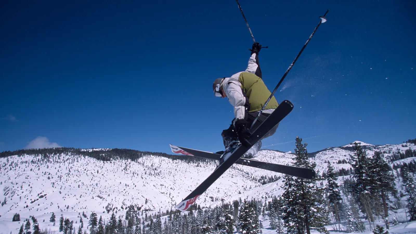
Dodge Ridge Ski Area
Overview
Dodge Ridge’s terrain numbers reveal a mountain built for the middle and upper end of the skill range. Of its 30.31 km of runs, only 2.45 km carries an easy rating – by far the thinnest slice of any difficulty band. Advanced terrain alone comes to 11.16 km, and adding the 1.13 km rated expert brings the harder terrain to roughly five times the length of the easy runs. Intermediate is the largest category outright at 15.57 km, so the mountain’s real center of gravity sits above beginner level, even though the biggest single chunk of terrain is intermediate rather than advanced. Worked out as percentages, that’s roughly 51% intermediate, 37% advanced, 8% easy, and 4% expert.
That terrain sits within the Stanislaus National Forest near Pinecrest, California, at roughly 38.19°N, 119.94°W, a Sierra Nevada location close enough to the Bay Area and the San Joaquin Valley that Dodge Ridge functions as a regular weekend option for Northern California skiers rather than a destination trip. The resort has a long operating history to match: it opened in 1950 and was managed early on by the Purdy family, then spent 45 seasons under the Helm family from 1976 until 2021-2022, when Invision Capital and Karl Kapuscinski took over ownership. Around that same ownership change, the resort added tubing and sledding, and the following summer it opened lift-served mountain biking and disc golf, extending the operation past the traditional ski season.
On the numbers, Dodge Ridge runs 11 lifts – seven chairlifts, a t-bar, and three magic carpets – across 56 runs, with a 478.9-meter vertical drop between a 2,003.3-meter base and a 2,482.2-meter summit. Spread over those 56 runs, the 30.31 km of terrain averages about 0.54 km per run, a fairly typical figure for a mid-sized California day resort. The resort is also a member of the Powder Alliance, a reciprocal pass program among regional resorts, and separately carries Indy Pass access at both the Base and Indy+ levels, giving skiers several ways to add it to a broader pass strategy.
Getting there means a Sierra foothills drive rather than a direct flight. Merced Regional sits closest at 112.6 km, with Mammoth Yosemite 114.9 km out and Stockton Metropolitan at 118.4 km; Reno-Tahoe International, 146.3 km away, remains the larger hub most out-of-state visitors use. Modesto, at 111.2 km, is the nearest sizable city, with Stockton (121.1 km) and Elk Grove (127.3 km) rounding out the closest population centers in the record – all of them Central Valley cities rather than mountain towns, which fits the resort’s role as a valley-adjacent day-trip destination.
The operator’s own trail map ships as a large image file on its site; SkiMap.org and OpenSkiMap.org both list the area too, so a visitor unfamiliar with the mountain has three independent sources to cross-check before picking a first run.
Key stats
Official website — Last checked 2026-09-13
Lifts by type
| Type | Count |
|---|---|
| t-bar | 1 |
| chair lift | 7 |
| magic carpet | 3 |
Runs by difficulty
| Difficulty | Distance |
|---|---|
| easy | 2.45 km |
| expert | 1.13 km |
| advanced | 11.16 km |
| intermediate | 15.57 km |
Maps
View official Dodge Ridge Ski Area trail map (image) →

Run & lift overview
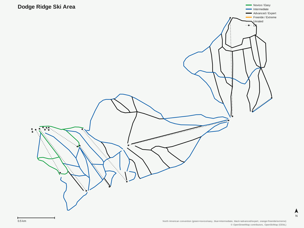
Dodge Ridge Ski Area: 57 runs, 11 lifts. A schematic built from OpenStreetMap/OpenSkiMap data — this is not Dodge Ridge Ski Area's official trail map. © OpenStreetMap contributors, OpenSkiMap (ODbL).
Typical conditions by month
Monthly conditions data for Dodge Ridge Ski Area is not yet available.
Lift tickets & passes
- Indy Base Pass — 2 All-Day or All-Night tickets per resort; blackout dates apply (exact 26/27 holiday blackout dates not yet finalized as of verified_date)
- Indy+ Pass — 2 All-Day or All-Night tickets per resort, no blackout dates
Getting there
Nearest airports
- Merced Regional Macready Field (MCE) — 112.6 km straight-line
- Mammoth Yosemite Airport (MMH) — 114.9 km straight-line
- Stockton Metropolitan Airport (SCK) — 118.4 km straight-line
Nearest cities
- Modesto, California — 111.2 km straight-line
- Stockton, California — 121.1 km straight-line
- Elk Grove, California — 127.3 km straight-line
Also covered by
Where to stay
A dedicated lodging guide for Dodge Ridge Ski Area is not yet available.
Nearby resorts
- Bear Valley — 34 km straight-line, 558.7 m vertical
- Kirkwood Mountain Resort — 56 km straight-line, 504.9 m vertical
- Sierra-at-Tahoe Ski Resort — 69 km straight-line, 662.7 m vertical
- June Mountain — 90 km straight-line, 780.5 m vertical
- Homewood Ski Area — 101 km straight-line, 499.6 m vertical
FAQ
- How much beginner terrain does Dodge Ridge have?
- Just 2.45 km out of 30.31 km total, the smallest of any difficulty band. Advanced and expert terrain combined (11.16 km plus 1.13 km, or 12.29 km) is roughly five times that amount, and intermediate terrain alone (15.57 km) also outweighs it heavily.
- Who owns Dodge Ridge Ski Area?
- The Purdy family managed it early on after it opened in 1950. The Helm family then owned and ran it from 1976 through the 2021-2022 season, after which Invision Capital and Karl Kapuscinski acquired the resort.
- Is Dodge Ridge part of a multi-resort pass?
- Yes -- Dodge Ridge is covered by both Indy Pass options, Base and Indy+, and per Wikipedia it also participates in the Powder Alliance reciprocal pass program, which offers discounted access at partner resorts across the western US.
- How do most visitors fly in to Dodge Ridge?
- Merced Regional is closest at 112.6 km, with Mammoth Yosemite at 114.9 km and Stockton Metropolitan at 118.4 km; the larger Reno-Tahoe International, 146.3 km out, serves as the area's main gateway for out-of-state visitors.
- How big is Dodge Ridge in lifts and runs?
- 11 lifts -- seven chairlifts, one t-bar, and three magic carpets -- serve 56 runs across 30.31 km, with a 478.9-meter vertical drop from a 2,003.3-meter base to a 2,482.2-meter summit, working out to roughly 0.54 km of run per trail.
- Is Dodge Ridge good for intermediate skiers?
- It's the resort's strong suit -- intermediate terrain is the largest single band at 15.57 km, just over half of all marked terrain, well ahead of the advanced (11.16 km) and easy (2.45 km) bands.
- What towns is Dodge Ridge close to?
- It sits near Pinecrest in Tuolumne County within the Stanislaus National Forest, drawing much of its traffic from the San Joaquin Valley and San Francisco Bay Area; Modesto, the nearest listed city, is 111.2 km away, followed by Stockton (121.1 km) and Elk Grove (127.3 km).
- What non-skiing activities does Dodge Ridge offer?
- The resort added tubing and sledding during the 2021-2022 season, and the following summer it installed lift-served access for mountain biking and disc golf -- diversifying the operation well beyond the winter months.
Data sources
Last verified: 2026-09-15
Base facts from OpenSkiMap (ODbL), OpenStreetMap contributors, Wikidata (CC0), OurAirports (public domain) and GeoNames (CC BY 4.0). See /data-sources/.