Big Rock Mountain
Overview
Key stats
Official website — Last checked 2026-09-13
Base elevation200.8 m
Top elevation487.1 m
Vertical drop286.3 m
Lifts4
Runs33
Total run distance10.68 km
Lifts by type
| Type | Count |
|---|---|
| chair lift | 3 |
| magic carpet | 1 |
Runs by difficulty
| Difficulty | Distance |
|---|---|
| easy | 0.88 km |
| advanced | 2.73 km |
| intermediate | 7.07 km |
Maps
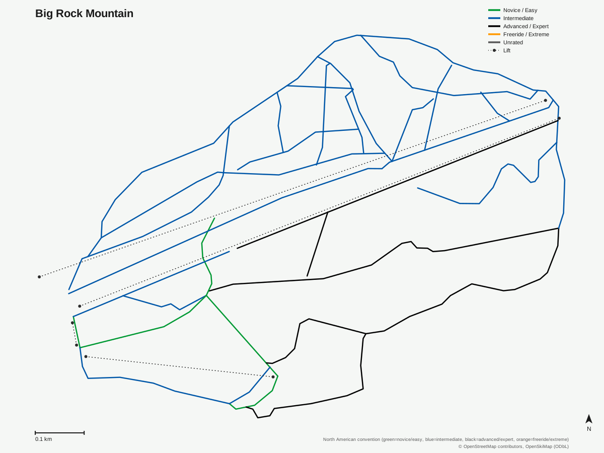
Big Rock Mountain: 33 runs, 4 lifts. Map data for Big Rock Mountain — © OpenStreetMap contributors, OpenSkiMap (ODbL)
Getting there
Nearest airports
- Presque Isle International Airport (PQI) — 25 km straight-line
- Fredericton International Airport (YFC) — 123.3 km straight-line
- Bathurst Airport (ZBF) — 200.1 km straight-line
Nearest cities
- Lévis, Quebec — 257.9 km straight-line
- Québec, Quebec — 260.8 km straight-line
- La Cité-Limoilou, Quebec — 261.9 km straight-line
Passes
- Indy Base Pass — 2 All-Day or All-Night tickets per resort; blackout dates apply (exact 26/27 holiday blackout dates not yet finalized as of verified_date)
- Indy+ Pass — 2 All-Day or All-Night tickets per resort, no blackout dates
Nearby resorts
- Crabbe Mountain — 71 km straight-line
- Mont Orignal — 212 km straight-line
- Parc du Mont-Comi — 218 km straight-line
- Mont Grand-Fonds — 221 km straight-line
- Le Massif — 227 km straight-line
FAQ
FAQ not yet available.
Data sources
Last verified: 2026-09-13
Base facts from OpenSkiMap (ODbL), OpenStreetMap contributors, Wikidata (CC0), OurAirports (public domain) and GeoNames (CC BY 4.0). See /data-sources/.