Lutsen Mountains
Overview
Key stats
Official website — Last checked 2026-09-13
Base elevation276.1 m
Top elevation511.9 m
Vertical drop235.8 m
Lifts8
Runs76
Total run distance27.33 km
Lifts by type
| Type | Count |
|---|---|
| gondola | 1 |
| chair lift | 6 |
| magic carpet | 1 |
Runs by difficulty
| Difficulty | Distance |
|---|---|
| easy | 1.45 km |
| expert | 0.74 km |
| novice | 0.06 km |
| advanced | 4.94 km |
| intermediate | 20.15 km |
Maps
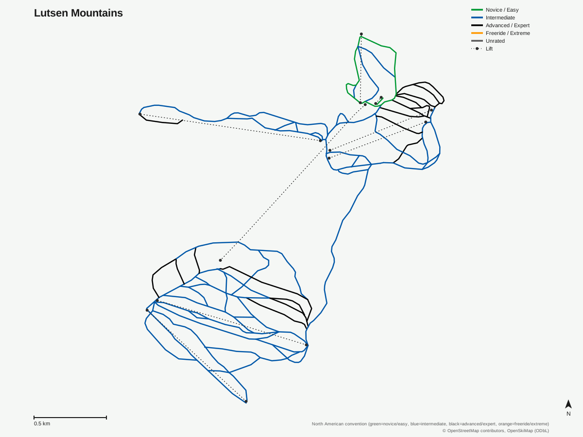
Lutsen Mountains: 76 runs, 8 lifts. Map data for Lutsen Mountains — © OpenStreetMap contributors, OpenSkiMap (ODbL)
Getting there
Nearest airports
- Thunder Bay International Airport (YQT) — 130.6 km straight-line
- Duluth International Airport (DLH) — 144 km straight-line
- Range Regional Airport (HIB) — 161.9 km straight-line
Nearest cities
- Thunder Bay, Ontario — 135.6 km straight-line
- Saint Paul, Minnesota — 352.6 km straight-line
- Minneapolis, Minnesota — 356.2 km straight-line
Passes
- Ikon Pass — 7 days, no blackout (new for 26/27)
- Ikon Base Pass — 5 days, blackout dates apply (new for 26/27)
Nearby resorts
- Granite Peak Ski Area — 314 km straight-line
- Georgian Peaks Club — 869 km straight-line
- Alpine Ski Club — 871 km straight-line
- Craigleith Ski Club — 873 km straight-line
- Blue Mountain Ski Resort — 875 km straight-line
FAQ
FAQ not yet available.
Data sources
Last verified: 2026-09-13
Base facts from OpenSkiMap (ODbL), OpenStreetMap contributors, Wikidata (CC0), OurAirports (public domain) and GeoNames (CC BY 4.0). See /data-sources/.