Granite Peak Ski Area
Overview
Key stats
Official website — Last checked 2026-09-13
Base elevation372.2 m
Top elevation573.4 m
Vertical drop201.2 m
Lifts7
Runs52
Total run distance19.52 km
Lifts by type
| Type | Count |
|---|---|
| chair lift | 5 |
| magic carpet | 2 |
Runs by difficulty
| Difficulty | Distance |
|---|---|
| easy | 3.76 km |
| other | 0.66 km |
| expert | 0.25 km |
| advanced | 8.14 km |
| intermediate | 6.71 km |
Maps
View official Granite Peak Ski Area trail map (PDF) →
Run & lift overview
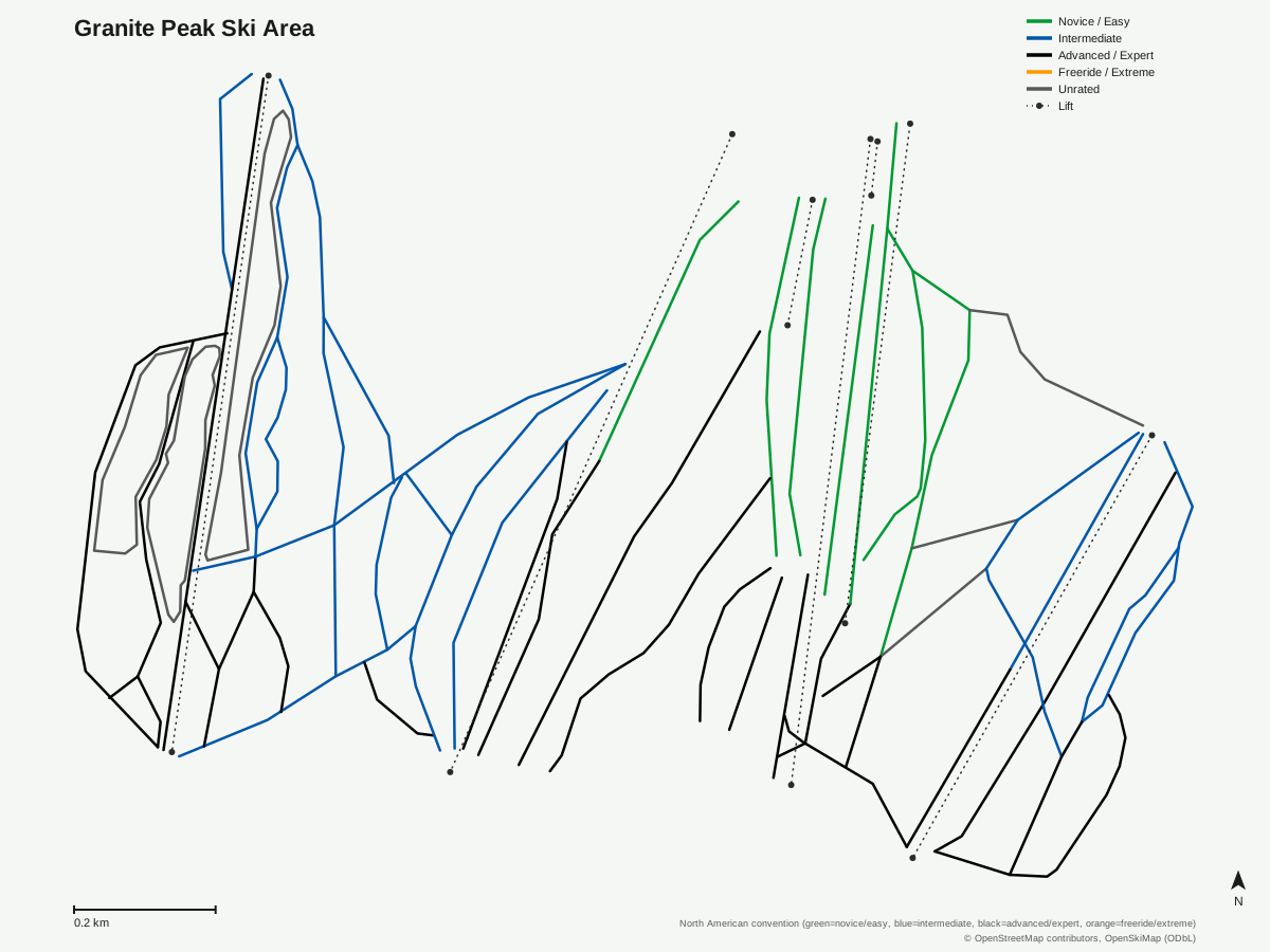
Granite Peak Ski Area: 55 runs, 7 lifts. Generated from community-mapped OpenStreetMap data, not Granite Peak Ski Area's official map artwork. © OpenStreetMap contributors, OpenSkiMap (ODbL).
Getting there
Nearest airports
- Central Wisconsin Airport (CWA) — 16.4 km straight-line
- Rhinelander Oneida County Airport (RHI) — 80.4 km straight-line
- Appleton International Airport (ATW) — 118.3 km straight-line
Nearest cities
- Green Bay, Wisconsin — 139 km straight-line
- Madison, Wisconsin — 207.1 km straight-line
- Rochester, Minnesota — 242.7 km straight-line
Passes
- Ikon Pass — 7 days, no blackout (new for 26/27)
- Ikon Base Pass — 5 days, blackout dates apply (new for 26/27)
Nearby resorts
- Lutsen Mountains — 314 km straight-line
- Blue Mountain Ski Resort — 741 km straight-line
- Holiday Valley — 934 km straight-line
- Seven Springs Mountain Resort — 1010 km straight-line
- Calabogie Peaks — 1012 km straight-line
FAQ
FAQ not yet available.
Data sources
Last verified: 2026-09-13
Base facts from OpenSkiMap (ODbL), OpenStreetMap contributors, Wikidata (CC0), OurAirports (public domain) and GeoNames (CC BY 4.0). See /data-sources/.