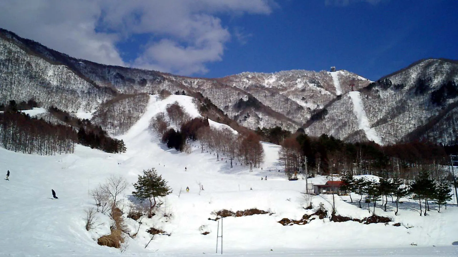
Ryuoo Ski Park
Overview
Ryuoo Ski Park sits above the town of Yamanouchi in Nagano Prefecture, on terrain that climbs to one of the higher summits among the region’s mid-size resorts: a base at 867.2 meters and a top station at 1,921.6 meters add up to 1,054.4 meters of vertical. Twelve lifts, a single cable car and 11 chairlifts, serve the mountain across 28 runs and a combined 12.43 kilometers of terrain. That terrain leans toward the steeper end of the scale for a resort this size: 4.49 kilometers are rated advanced against 3.58 kilometers easy and 3.97 kilometers intermediate, putting more of the mountain in demanding territory than in beginner terrain.
Ryuoo is one of seven ski areas operated by Nippon Ski Resort Development, a group whose other properties span Gunma and Gifu prefectures as well as Nagano. That corporate scale shows up most clearly in the resort’s non-skiing attraction: SORA Terrace, a ropeway-accessed observation platform built for viewing seas of cloud from near the summit, complete with its own cafe and, once the snow melts, a glamping operation on the same site. The ropeway also runs night departures during parts of the season, giving the resort a second identity as a scenic lookout destination independent of its ski terrain.
That mix of a genuinely tall vertical, an advanced-leaning run profile, and a marquee non-ski attraction sets Ryuoo apart from resorts in the area built primarily as learning hills. It reads less like a beginner-friendly day resort and more like a compact mountain aimed at skiers who want real pitch, with the SORA Terrace pulling in a separate crowd that may never put on skis at all.
Access into Ryuoo sits closer to central Nagano than at many of its regional peers. Nagano city itself is only 29.3 kilometers away, with Ueda at 45.3 kilometers and Jōetsu, across the prefectural line in Niigata, at 45.7 kilometers. Flying in, Shinshu-Matsumoto Airport is a shorter hop than at most comparable resorts nearby at just 83.9 kilometers, Toyama Kitokito Airport sits in between at 115.1 kilometers, and Niigata Airport, the region’s larger hub, is furthest at 142.3 kilometers. Ryuoo doesn’t show up on any of the region’s bundled lift-pass products, so admission is a straight ticket purchase at the resort itself. For skiers weighing where to spend a day trip out of Nagano, Ryuoo’s combination of vertical, terrain difficulty, and a scenic ropeway attraction gives it a different pitch than the easier, family-oriented resorts closer to the city center.
Key stats
Official website — Last checked 2026-09-13
Lifts by type
| Type | Count |
|---|---|
| cable car | 1 |
| chair lift | 11 |
Runs by difficulty
| Difficulty | Distance |
|---|---|
| easy | 3.58 km |
| other | 0.4 km |
| advanced | 4.49 km |
| intermediate | 3.97 km |
Maps
View official Ryuoo Ski Park trail map (PDF) →
Run & lift overview
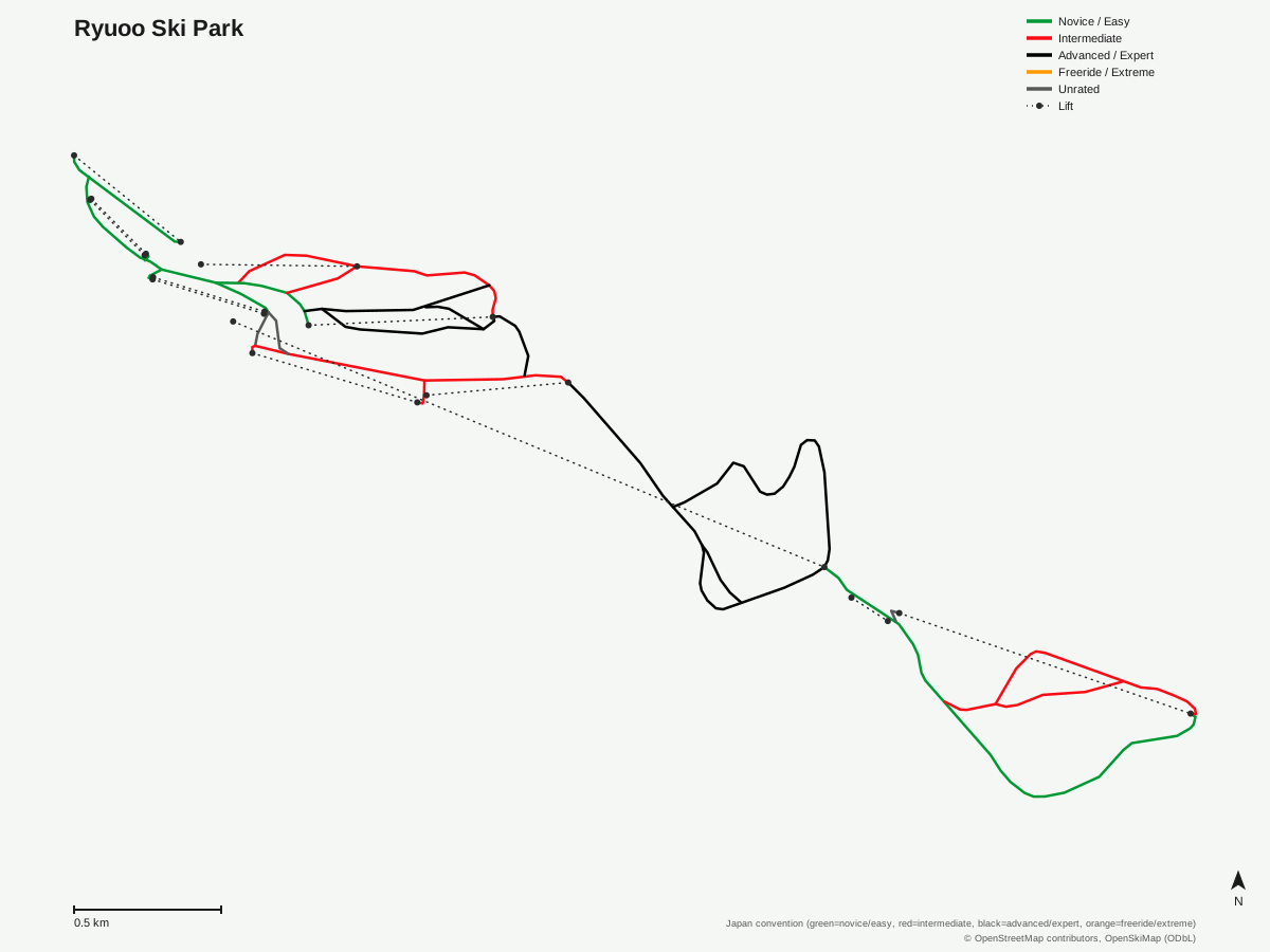
Ryuoo Ski Park: 28 runs, 12 lifts. A schematic built from OpenStreetMap/OpenSkiMap data — this is not Ryuoo Ski Park's official trail map. © OpenStreetMap contributors, OpenSkiMap (ODbL).
Typical conditions by month
Monthly conditions data for Ryuoo Ski Park is not yet available.
Lift tickets & passes
Ryuoo Ski Park has no multi-resort pass affiliations on record.
Getting there
Nearest airports
- Shinshu-Matsumoto Airport (MMJ) — 83.9 km straight-line
- Toyama Kitokito Airport (TOY) — 115.1 km straight-line
- Niigata Airport (KIJ) — 142.3 km straight-line
Nearest cities
- Nagano, Nagano — 29.3 km straight-line
- Ueda, Nagano — 45.3 km straight-line
- Jōetsu, Niigata — 45.7 km straight-line
Also covered by
Where to stay
A dedicated lodging guide for Ryuoo Ski Park is not yet available.
Nearby resorts
- Kitashiga Komaruyama Ski Resort — 2 km straight-line, 315.5 m vertical
- Shiga Kogen Okushiga Kogen Ski Area — 5 km straight-line, 524.8 m vertical
- Shiga Kogen Yakebitaiyama Ski Area — 5 km straight-line, 449.8 m vertical
- X-JAM Takaifuji — 5 km straight-line, 234.8 m vertical
- Yomase Onsen Ski Area — 5 km straight-line, 450.3 m vertical
FAQ
- How big is Ryuoo Ski Park?
- Ryuoo has a vertical drop of 1,054.4 meters, climbing from a base of 867.2 meters to a top elevation of 1,921.6 meters, one of the taller verticals among the smaller Nagano-area resorts. Twelve lifts, a single cable car plus 11 chairlifts, serve 28 runs totaling 12.43 kilometers.
- Is Ryuoo good for advanced skiers?
- Ryuoo leans toward the demanding end for its size, with 4.49 kilometers of runs rated advanced against 3.58 kilometers easy and 3.97 kilometers intermediate. That's a higher share of advanced terrain relative to total run length than most nearby resorts of comparable size.
- Is Ryuoo good for beginners?
- There is easy terrain at Ryuoo, about 3.58 kilometers of it, but it makes up a smaller share of the mountain than the advanced and intermediate categories combined. Beginners can find groomed runs to progress on, but the resort as a whole is built more for confident skiers than complete newcomers.
- What is the SORA Terrace at Ryuoo?
- SORA Terrace is a ropeway-accessed observation platform near the summit built for viewing seas of cloud below, paired with a cafe and, outside ski season, a glamping operation on the same site. It's a scenic, non-skiing attraction that draws visitors who may never clip into skis, alongside a night ropeway departure during parts of the season.
- What company operates Ryuoo Ski Park?
- Ryuoo is one of seven ski areas run by Nippon Ski Resort Development, a group that also operates resorts across Gunma and Gifu prefectures in addition to Nagano. That group ownership links Ryuoo's lift-ticket and marketing systems to sister resorts elsewhere in Japan.
- What is the nearest airport to Ryuoo Ski Park?
- Shinshu-Matsumoto Airport is closest at 83.9 kilometers, notably nearer than at most other resorts in this part of Japan, with Toyama Kitokito Airport at 115.1 kilometers. Niigata Airport, the larger regional gateway, sits furthest at 142.3 kilometers.
- Which ski pass covers Ryuoo Ski Park?
- No multi-resort lift pass currently lists Ryuoo in the available data, so admission runs through the resort's own lift tickets. Visitors comparing passes across the region should check separately rather than assuming Ryuoo is bundled with nearby Nagano resorts.
- How far is Ryuoo Ski Park from Nagano city?
- Nagano city is 29.3 kilometers away, the closest of the three nearby cities in the data, with Ueda at 45.3 kilometers and Jōetsu just beyond that at 45.7 kilometers. That puts Ryuoo within reasonably easy reach of central Nagano compared with resorts further out toward the Niigata border.
Data sources
Last verified: 2026-09-15
Base facts from OpenSkiMap (ODbL), OpenStreetMap contributors, Wikidata (CC0), OurAirports (public domain) and GeoNames (CC BY 4.0). See /data-sources/.