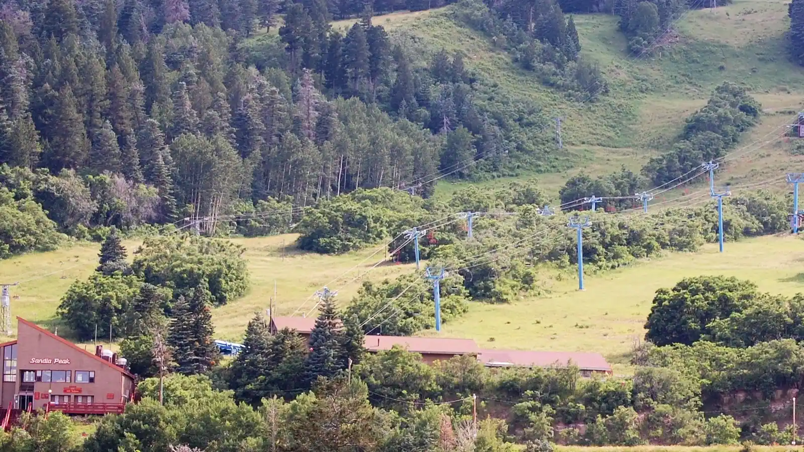
Sandia Peak Ski Area
Overview
Few ski areas in the country sit as close to a major city as Sandia Peak does to Albuquerque. The mountain rises directly northeast of downtown, at about 35.20°N, 106.42°W, and the resort is reachable both by driving up and by riding the Sandia Peak Tramway, a scenic aerial route that shares the same resort and summit as the ski area. The tram opened in 1966 and held the record as the world’s longest until 2010; it remains the longest in the Americas, and its summit restaurant, 10 3, has built a reputation as one of the highest-elevation dining rooms in the country.
Skiing here predates the tram by three decades. The Albuquerque Ski Club, started by Robert Nordhaus, opened a rope-tow operation called La Madera in 1936. It was rebranded Sandia Peak Ski Area in 1962-63 when the area’s first chairlift arrived, making it New Mexico’s first true ski resort. That history gives Sandia Peak a claim to seniority in the state even though its terrain footprint today – 66 runs over 25.43 km – is modest next to bigger New Mexico and Colorado neighbors.
The mountain’s terrain leans toward the middle of the difficulty scale. Intermediate runs account for 13.03 km, more than half the total, while easy terrain adds another 7.47 km and novice runs 2.33 km. Advanced terrain is comparatively scarce at 2.61 km, so this isn’t a resort built around expert lines – it’s a place where cruising runs and moderate pitches make up most of the mountain. In percentage terms, that’s roughly 51% intermediate, 29% easy, 10% advanced, and 9% novice. Spread across 66 runs, that shakes out to roughly 0.39 km per run, among the shortest per-run figures of any resort in this batch. Six lifts, including two cable cars, three chairlifts, and a drag lift, carry skiers up a 487.4-meter vertical rise from a 2,645.7-meter base to the 3,133.1-meter summit.
Access is about as convenient as ski travel gets. Albuquerque International Sunport sits 24.6 km from the resort, with Santa Fe Municipal 55.3 km away and Taos Regional farther out at 154.5 km. Albuquerque itself, home to over half a million people, is only 24.5 km from the slopes – a genuine day-trip distance that few other ski areas in this dataset can match. The next-closest cities in the record are far more distant: Las Cruces sits 322.9 km away and Pueblo, Colorado, 376.0 km, underscoring how much Sandia Peak’s draw depends on a single nearby metro area rather than a spread of regional population centers. Unlike some of its neighbors, the resort currently carries no listed multi-resort pass affiliation.
Sandia Peak also publishes its own dedicated trail-map page directly on its website, separate from the general resort information. Beyond that official page, the ski area shows up in two independent catalogs, SkiMap.org and OpenSkiMap.org, giving visitors more than one source to cross-check terrain and layout before heading up from the city below.
Key stats
Official website — Last checked 2026-09-13
Lifts by type
| Type | Count |
|---|---|
| cable car | 2 |
| drag lift | 1 |
| chair lift | 3 |
Runs by difficulty
| Difficulty | Distance |
|---|---|
| easy | 7.47 km |
| novice | 2.33 km |
| advanced | 2.61 km |
| intermediate | 13.03 km |
Maps
View official Sandia Peak Ski Area trail map (page) →
Run & lift overview
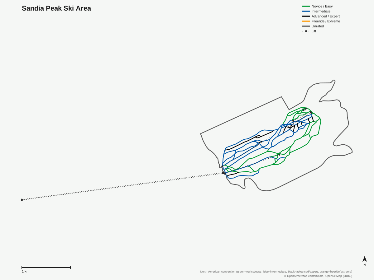
Sandia Peak Ski Area: 67 runs, 6 lifts. Drawn from OpenStreetMap run and lift data — not the official Sandia Peak Ski Area trail map. © OpenStreetMap contributors, OpenSkiMap (ODbL).
Typical conditions by month
Monthly conditions data for Sandia Peak Ski Area is not yet available.
Lift tickets & passes
Sandia Peak Ski Area has no multi-resort pass affiliations on record.
Getting there
Nearest airports
- Albuquerque International Sunport (ABQ) — 24.6 km straight-line
- Santa Fe Municipal Airport (SAF) — 55.3 km straight-line
- Taos Regional Airport (TSM) — 154.5 km straight-line
Nearest cities
- Albuquerque, New Mexico — 24.5 km straight-line
- Las Cruces, New Mexico — 322.9 km straight-line
- Pueblo, Colorado — 376 km straight-line
Where to stay
A dedicated lodging guide for Sandia Peak Ski Area is not yet available.
Nearby resorts
- Pajarito Mountain — 77 km straight-line, 443.3 m vertical
- Ski Santa Fe — 87 km straight-line, 534.4 m vertical
- Sipapu Ski and Summer Resort — 132 km straight-line, 322.8 m vertical
- Angel Fire Resort — 169 km straight-line, 638.1 m vertical
- Taos Ski Valley — 176 km straight-line, 752.2 m vertical
FAQ
- How close is Sandia Peak to Albuquerque?
- Very close -- 24.5 km from the city center and 24.6 km from Albuquerque International Sunport (ABQ), making it one of the few US ski areas reachable on a direct drive from a major metro area of over half a million people.
- Can you reach Sandia Peak by the tramway?
- The Sandia Peak Tramway and the ski area are part of the same resort and both reach the summit, giving skiers an alternate route up the mountain alongside the ground road. The tram dates to 1966 and was the world's longest until 2010, and remains the longest in the Americas.
- When did skiing start on Sandia Peak?
- The Albuquerque Ski Club, founded by Robert Nordhaus, opened a rope-tow area called La Madera in 1936. It was renamed Sandia Peak Ski Area in 1962-63 when the first chairlift went in, making it New Mexico's first ski area.
- What's the terrain split at Sandia Peak?
- Intermediate terrain dominates at 13.03 km of the 25.43 km total, with easy runs at 7.47 km, novice at 2.33 km, and advanced the smallest band at 2.61 km -- an average run length across all 66 runs of about 0.39 km.
- Is Sandia Peak good for beginners?
- Reasonably -- easy and novice terrain combined (9.8 km) make up close to 40% of the mountain, and advanced-only terrain is a small fraction, so it isn't a steep-and-deep destination in the way some of its high-alpine neighbors are.
- What's the nearest airport to Sandia Peak?
- Albuquerque International Sunport, 24.6 km away -- about as short a drive from a large hub airport as any resort gets. Santa Fe Municipal is next at 55.3 km, and Taos Regional is farther out at 154.5 km.
- How many lifts does Sandia Peak Ski Area have?
- Six: two cable cars, three chairlifts, and one drag lift, serving 66 runs over 25.43 km with a 487.4-meter vertical drop from 2,645.7 to 3,133.1 meters.
- Is Sandia Peak part of a multi-resort ski pass?
- No pass affiliation is listed in the current data for Sandia Peak Ski Area, unlike several of the other resorts in this region that carry Indy Pass or similar reciprocal-access programs.
Data sources
Last verified: 2026-09-15
Base facts from OpenSkiMap (ODbL), OpenStreetMap contributors, Wikidata (CC0), OurAirports (public domain) and GeoNames (CC BY 4.0). See /data-sources/.