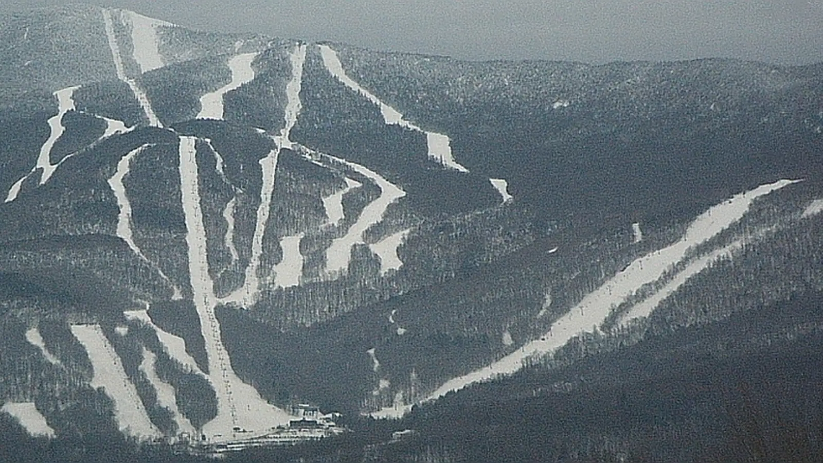
Sugarbush Resort
Overview
Sugarbush opened on Christmas Day, 1958, founded by Damon and Sara Gadd together with Jack Murphy, and has grown since into two connected mountains rather than one. Lincoln Peak, the original and larger side, carries most of the resort’s lodging and base infrastructure. Mount Ellen joined in 1979 when Sugarbush absorbed the formerly independent Glen Ellen Ski Area, and the two are now linked by the Slide Brook Express, a lift long enough to have been called the world’s longest detachable chairlift, covering roughly 4 km between the two peaks.
The terrain across both mountains adds up to 142 runs and 80.48 km, with a vertical drop of 777.8 m from a 460.5 m base to a 1,238.3 m summit. Intermediate skiing dominates the run mix at 35.18 km, ahead of 27.95 km advanced, 13.17 km easy, 3.92 km expert, and a slim 0.26 km of novice terrain. Eighteen lifts do the work: 13 chairlifts, a t-bar, 2 platters, and 2 magic carpets concentrated near the base areas for first-timers. The resort’s identity, though, runs through two specific zones that don’t show up in the aggregate numbers. Castlerock Peak is Sugarbush’s one section without snowmaking, left to natural conditions on purpose, with narrow, steep New England-style trails that locals treat as the resort’s proving ground. Slide Brook Basin, on the far side of the connector lift, covers more than 1,000 acres of expert-only wooded terrain that isn’t routinely patrolled, a scale of ungroomed backcountry-style skiing unusual for a lift-served Vermont resort.
Mount Ellen, meanwhile, hosts the resort’s terrain park facilities on the Riemergasse and Sugar Run trails, giving Sugarbush a clear split between its groomed, park-oriented side and Lincoln Peak’s steeper, more natural terrain. Alterra Mountain Company has owned Sugarbush since buying it in November 2019. Season pass holders reach the mountain through either half of the Ikon lineup: the unrestricted Ikon Pass any day of the season, or the Ikon Base Pass minus a handful of blackout dates concentrated around peak holiday periods.
Access runs through three regional airports rather than a single major hub: Burlington’s Patrick Leahy International (41.0 km) is closest, with Rutland - Southern Vermont Regional (68.9 km) and Plattsburgh International across the New York border (71.5 km) as alternatives. Montreal, on the Canadian side, sits considerably further out, with Quebec cities like Longueuil, Ville-Marie, and Sherbrooke all in the 158-160 km range, making Sugarbush more a Vermont-and-Burlington-area resort than a Montreal day-trip option despite the international border’s proximity on a map.
Key stats
Official website — Last checked 2026-09-14
Lifts by type
| Type | Count |
|---|---|
| t-bar | 1 |
| platter | 2 |
| chair lift | 13 |
| magic carpet | 2 |
Runs by difficulty
| Difficulty | Distance |
|---|---|
| easy | 13.17 km |
| expert | 3.92 km |
| novice | 0.26 km |
| advanced | 27.95 km |
| intermediate | 35.18 km |
Maps
View official Sugarbush Resort trail map (PDF) →
Run & lift overview
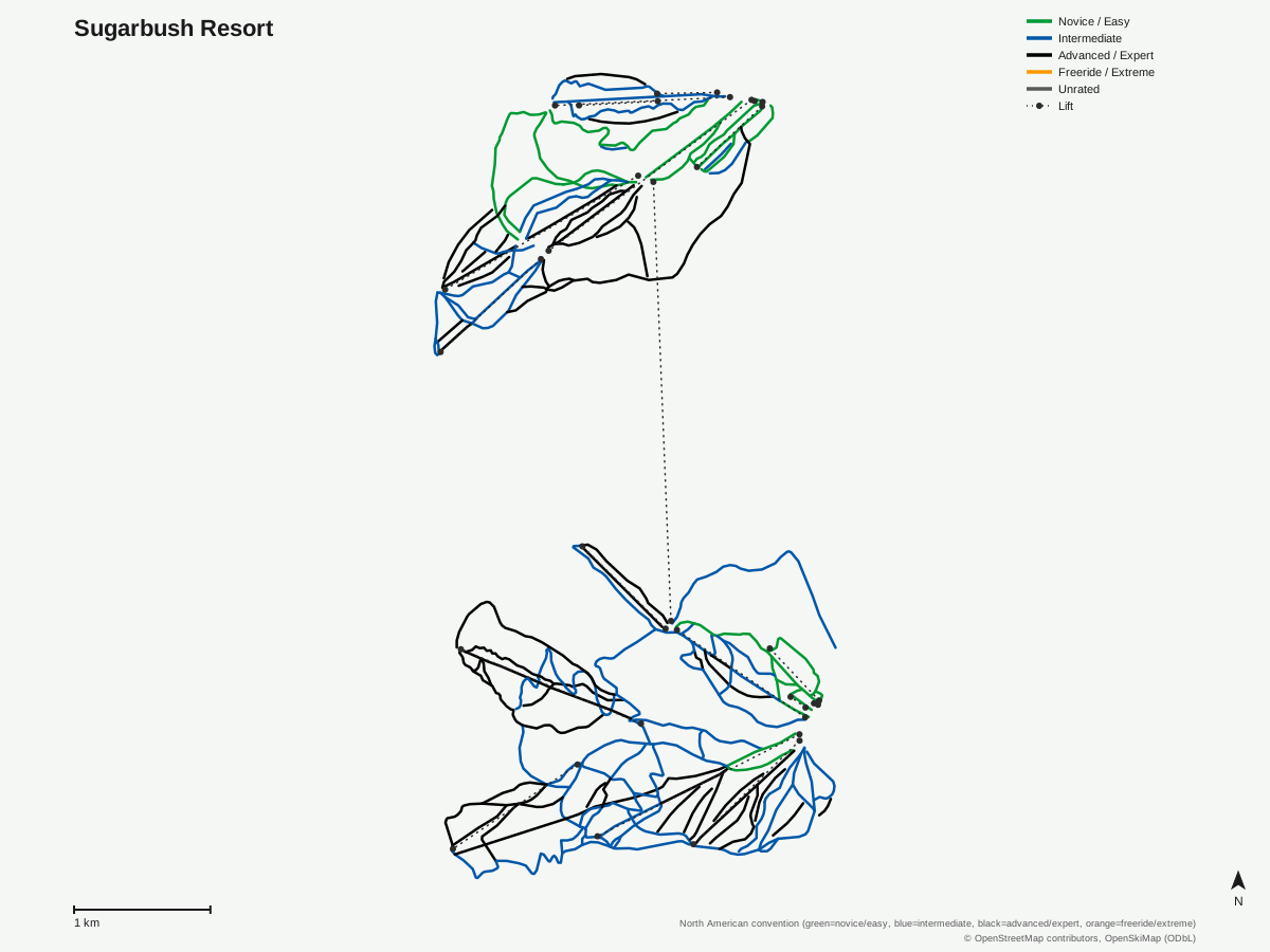
Sugarbush Resort: 142 runs, 18 lifts. Drawn from OpenStreetMap run and lift data — not the official Sugarbush Resort trail map. © OpenStreetMap contributors, OpenSkiMap (ODbL).
Typical conditions by month
Monthly conditions data for Sugarbush Resort is not yet available.
Lift tickets & passes
- Ikon Pass — Unlimited, no blackout
- Ikon Base Pass — Unlimited, blackout dates apply
Getting there
Nearest airports
- Patrick Leahy Burlington International Airport (BTV) — 41 km straight-line
- Rutland - Southern Vermont Regional Airport (RUT) — 68.9 km straight-line
- Plattsburgh International Airport (PBG) — 71.5 km straight-line
Nearest cities
- Longueuil, Quebec — 158.3 km straight-line
- Ville-Marie, Quebec — 159 km straight-line
- Sherbrooke, Quebec — 160.4 km straight-line
Also covered by
Where to stay
A dedicated lodging guide for Sugarbush Resort is not yet available.
Nearby resorts
- Mad River Glen — 6 km straight-line, 604.2 m vertical
- Middlebury College Snow Bowl — 24 km straight-line, 290.3 m vertical
- Bolton Valley Resort — 30 km straight-line, 474.3 m vertical
- Stowe Mountain Resort — 44 km straight-line, 711.8 m vertical
- Smugglers' Notch Resort — 48 km straight-line, 771.7 m vertical
FAQ
- How big is Sugarbush Resort?
- Sugarbush has 142 runs totaling 80.48 km, with a vertical drop of 777.8 m from a 460.5 m base to a 1,238.3 m summit. It's served by 18 lifts: 13 chairlifts, a t-bar, 2 platters, and 2 magic carpets, spread across two connected mountains, Lincoln Peak and Mount Ellen.
- Is Sugarbush good for beginners?
- There's 13.17 km of easy terrain plus a small 0.26 km novice strip, concentrated around the base areas with 2 magic carpets to match. It's a smaller share of the resort's overall terrain than the 35.18 km of intermediate runs, which make up the largest single category at Sugarbush.
- Is Sugarbush good for experts?
- Yes, especially on Castlerock Peak and in Slide Brook Basin. Castlerock is Sugarbush's one peak without snowmaking, keeping its narrow, steep New England-style trails closest to natural conditions, while Slide Brook Basin covers over 1,000 acres of expert-only wooded terrain that isn't routinely patrolled. Resort-wide, advanced and expert terrain together total 31.87 km.
- Which pass covers Sugarbush?
- Both tiers of the Ikon lineup work here. The unrestricted Ikon Pass skis Sugarbush on any operating day with no blackout dates, while Ikon Base Pass holders lose access on a set of blackout dates, typically around the busiest holiday stretches.
- What's the nearest airport to Sugarbush?
- Patrick Leahy Burlington International Airport (BTV) is closest at 41.0 km. Rutland - Southern Vermont Regional (RUT) is 68.9 km away, and Plattsburgh International (PBG) across the New York border is 71.5 km, giving visitors three regional options before considering Montreal.
- How old is Sugarbush Resort?
- Sugarbush opened on December 25, 1958, founded by Damon and Sara Gadd along with Jack Murphy. It absorbed the neighboring Glen Ellen Ski Area in 1979, which became today's Mount Ellen, and has been owned by Alterra Mountain Company since November 2019.
- How are Sugarbush's two mountains connected?
- Lincoln Peak and Mount Ellen, roughly 4 km apart, are linked by the Slide Brook Express, a lift long enough that it has been described as the world's longest detachable chairlift. Most of Sugarbush's lodging and services sit on the Lincoln Peak side.
- Does Sugarbush have terrain parks?
- Yes, the terrain park facilities are located on Mount Ellen, on the Riemergasse and Sugar Run trails, separate from the steeper natural terrain on Castlerock Peak and in Slide Brook Basin on the Lincoln Peak side.
Data sources
Last verified: 2026-09-15
Base facts from OpenSkiMap (ODbL), OpenStreetMap contributors, Wikidata (CC0), OurAirports (public domain) and GeoNames (CC BY 4.0). See /data-sources/.