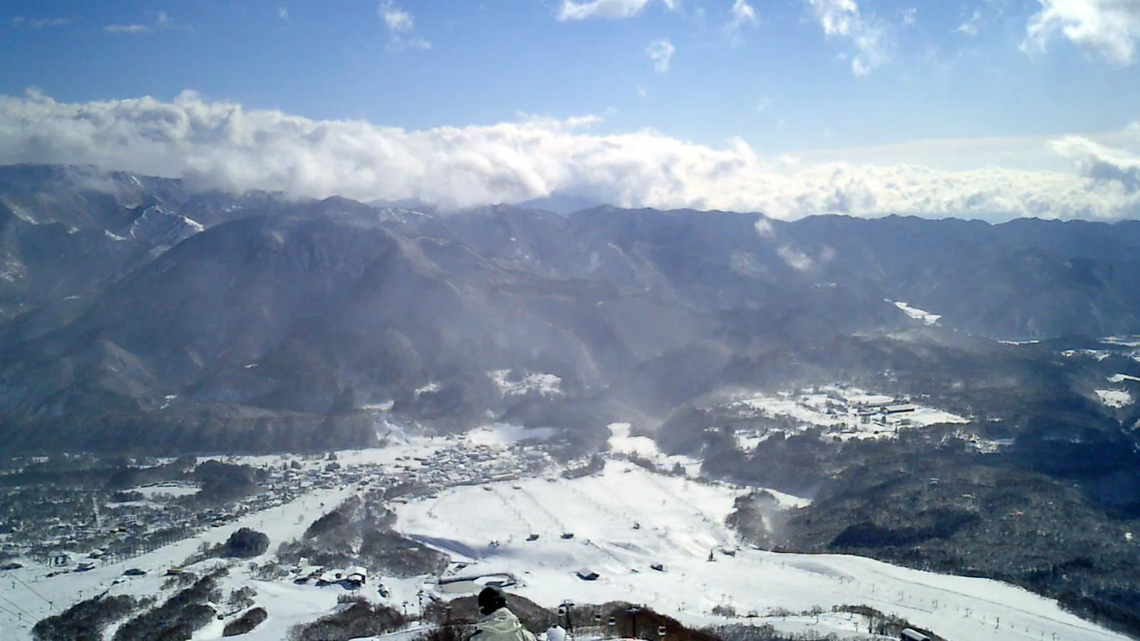
Tsugaike Kogen
Overview
Tsugaike Kogen sits in Otari Village, Nagano Prefecture, as one of the ten resorts that make up the Hakuba Valley region. Its lift lineup is built around moving skiers up the mountain quickly rather than around a dense chairlift network: a single gondola and a cable car work alongside 13 chairlifts, 15 lifts in total, lifting skiers from a base of 803.2 meters to a top station at 1,706.8 meters, a vertical gain of 903.6 meters. Across 36 runs and 34.28 kilometers of terrain, the mountain leans harder toward easy skiing than most resorts nearby: 19.63 kilometers, more than half the total, are rated easy, with 9.87 kilometers intermediate and just 3.17 kilometers advanced.
The resort’s gondola, known as Ève, is one of the longer lift lines in Japan, running roughly 20 minutes end to end, and it works together with a five-minute ropeway to carry skiers, and in the warmer months hikers, up toward Tsugaike Shizen-en. That alpine wetland nature garden sits inside Chubu-Sangaku National Park and draws visitors for its wildflowers and for views toward the Hakuba Daisekkei snowfield and the Hakuba Three Mountains once the snow clears. It’s a green-season attraction built on the same lift infrastructure that carries skiers in winter, giving Tsugaike a year-round identity beyond its ski terrain.
Because Tsugaike sits inside the Hakuba Valley grouping, it’s covered by the Hakuba Valley All-Mountain Pass, which grants unlimited access across all ten resorts in the region on both day-ticket and season-pass products. That means a lift ticket bought for a Tsugaike day can just as easily be used to ski the other Hakuba-area mountains nearby, rather than being limited to Tsugaike’s own 36 runs. Combined with its easy-leaning terrain, that makes Tsugaike a natural entry point into the wider Hakuba Valley for less experienced skiers who want room to progress before venturing to the steeper resorts elsewhere in the valley, including Happo-One and Goryu a short drive down the road.
Access into the area runs mainly through Toyama Kitokito Airport, the nearest at 60.4 kilometers, with Shinshu-Matsumoto Airport close behind at 65.9 kilometers and Komatsu Airport, the larger regional gateway, at 135.2 kilometers. By road, Nagano city is the closest at 31.8 kilometers, and Ueda and Jōetsu sit almost side by side at 55 and 55.4 kilometers respectively. Between its long gondola-and-ropeway access, its markedly easy-leaning terrain, and its place inside the shared Hakuba Valley pass network, Tsugaike works less as a standalone resort and more as one wide, approachable piece of a much larger connected ski region.
Key stats
Official website — Last checked 2026-09-13
Lifts by type
| Type | Count |
|---|---|
| gondola | 1 |
| cable car | 1 |
| chair lift | 13 |
Runs by difficulty
| Difficulty | Distance |
|---|---|
| easy | 19.63 km |
| other | 1.61 km |
| advanced | 3.17 km |
| intermediate | 9.87 km |
Maps
View official Tsugaike Kogen trail map (PDF) →
Run & lift overview
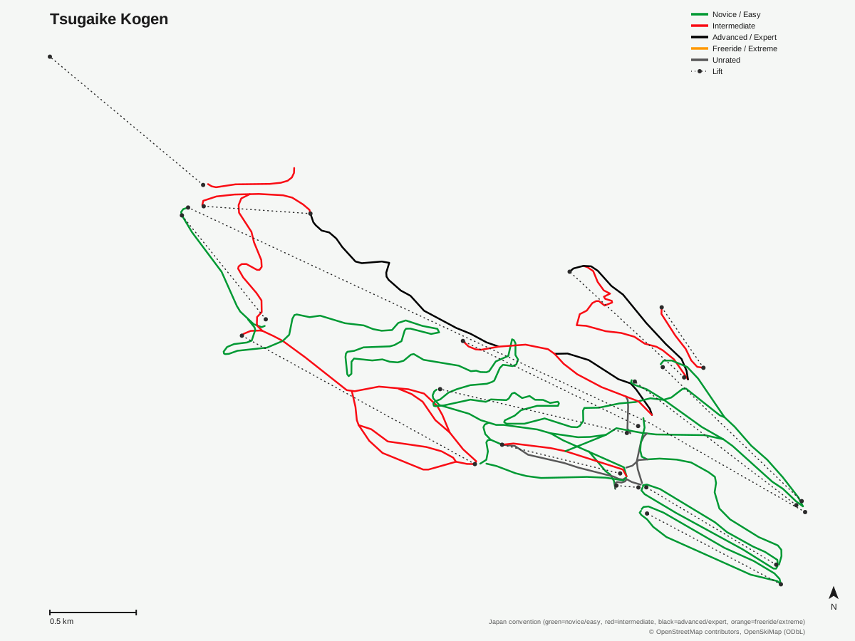
Tsugaike Kogen: 36 runs, 15 lifts. Generated from community-mapped OpenStreetMap data, not Tsugaike Kogen's official map artwork. © OpenStreetMap contributors, OpenSkiMap (ODbL).
Typical conditions by month
Monthly conditions data for Tsugaike Kogen is not yet available.
Lift tickets & passes
- Epic Pass — One complimentary 5-day Hakuba Valley ticket (all 10 areas), consecutive days from first use (shuttle-only use counts; 10 days total combined with Rusutsu); no blackout dates; excludes night skiing and night shuttles
- Epic Local Pass — One complimentary 5-day Hakuba Valley ticket (all 10 areas), consecutive days from first use (shuttle-only use counts; 10 days total combined with Rusutsu); no blackout dates; excludes night skiing and night shuttles
- Hakuba Valley All-Mountain Pass — Unlimited across all 10 Hakuba Valley areas (day pass and season pass products both cover all 10)
Getting there
Nearest airports
- Toyama Kitokito Airport (TOY) — 60.4 km straight-line
- Shinshu-Matsumoto Airport (MMJ) — 65.9 km straight-line
- Noto Satoyama Airport (NTQ) — 99 km straight-line
Nearest cities
- Nagano, Nagano — 31.8 km straight-line
- Ueda, Nagano — 55 km straight-line
- Jōetsu, Niigata — 55.4 km straight-line
Also covered by
Where to stay
A dedicated lodging guide for Tsugaike Kogen is not yet available.
Nearby resorts
- Hakuba Norikura Onsen Ski Resort — 2 km straight-line, 468.6 m vertical
- Hakuba Cortina — 4 km straight-line, 583.2 m vertical
- Hakuba Iwatake — 4 km straight-line, 536.5 m vertical
- Hakuba Happo One — 6 km straight-line, 1076.8 m vertical
- Hakuba 47 — 9 km straight-line, 819.8 m vertical
FAQ
- How big is Tsugaike Kogen?
- Tsugaike Kogen has a vertical drop of 903.6 meters, from a base of 803.2 meters to a top station at 1,706.8 meters, across 36 runs totaling 34.28 kilometers. Fifteen lifts serve the mountain: one gondola, one cable car, and 13 chairlifts.
- Is Tsugaike Kogen good for beginners?
- Yes, more than any other resort in this part of Nagano: 19.63 of the 34.28 total kilometers are rated easy, well over half the mountain, against just 3.17 kilometers advanced. The terrain profile favors long, gentle cruising runs rather than steep pitches.
- Is Tsugaike Kogen good for advanced skiers?
- Not primarily. Only 3.17 kilometers of the resort's 34.28 kilometers of runs are rated advanced, the smallest advanced share by proportion of any resort in this cluster. Stronger skiers can find some terrain, but Tsugaike is built more around accessible cruising than expert-level pitches.
- Which ski pass covers Tsugaike Kogen?
- Tsugaike Kogen is covered by the Hakuba Valley All-Mountain Pass, which grants unlimited access across all ten Hakuba Valley resorts on both day-ticket and season-pass products. A lift ticket bought under that pass opens up terrain well beyond Tsugaike's own 36 runs.
- What is Tsugaike Shizen-en?
- Tsugaike Shizen-en is an alpine wetland nature garden inside Chubu-Sangaku National Park, reached via the resort's Ève gondola and a connecting ropeway. It draws visitors for its wildflowers and for views toward the Hakuba Daisekkei snowfield and the Hakuba Three Mountains once the winter snow has melted.
- What is the nearest airport to Tsugaike Kogen?
- Toyama Kitokito Airport is closest at 60.4 kilometers, with Shinshu-Matsumoto Airport close behind at 65.9 kilometers. Komatsu Airport, the larger regional gateway, is 135.2 kilometers away.
- Is Tsugaike Kogen part of Hakuba Valley?
- Yes, Tsugaike Kogen is one of the ten ski areas that make up the Hakuba Valley region, and it's covered by the region's shared all-mountain lift pass. That connection means a Tsugaike-based trip can easily extend into skiing the other Hakuba resorts on the same pass.
- How far is Tsugaike Kogen from Nagano city?
- Nagano city is 31.8 kilometers from Tsugaike Kogen, the closest of the three nearby cities in the data, with Ueda at 55 kilometers and Jōetsu just beyond that at 55.4 kilometers. That keeps the resort within a reasonable day's travel of central Nagano.
Data sources
Last verified: 2026-09-15
Base facts from OpenSkiMap (ODbL), OpenStreetMap contributors, Wikidata (CC0), OurAirports (public domain) and GeoNames (CC BY 4.0). See /data-sources/.